Area Overview for Broomfield
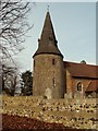
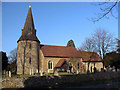
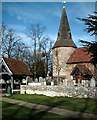
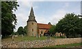
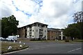
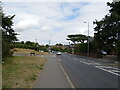
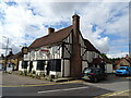
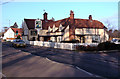
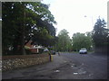
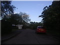
Photos of Broomfield


Area Information
Living in Broomfield offers a compact, well-defined urban experience within England’s built-up areas. Covering just 1.3 km², the area is tightly knit, with a population profile that skews older, as the median age is 70. This suggests a community with a strong sense of continuity, where many residents may have lived for decades. The area’s proximity to Chelmsford and surrounding towns makes it a practical choice for those seeking a quieter, established environment without sacrificing access to nearby services. Daily life in Broomfield balances local amenities with the convenience of nearby transport links, such as Chelmsford Railway Station. The presence of schools like Broomfield Primary and Chelmer Valley High School adds to the area’s appeal for families, though the mix of school types reflects a blend of traditional and academy-led education. For buyers, Broomfield’s compact size and mature demographic may appeal to those prioritising stability and proximity to essential services.
- Area Type
- Built Up Area 250
- Area Size
- 1.3 km²
- Population
- Not available
- Population Density
- Not available
Broomfield’s lifestyle is shaped by its proximity to retail hubs like M&S Broomfield, Waitrose Little, and Morrisons Chelmsford, offering a range of shopping options within reach. The area’s two railway stations also provide access to dining, leisure, and cultural opportunities in Chelmsford. While the data does not specify parks or recreational facilities, the presence of multiple retail outlets and transport links suggests a focus on practical convenience. For residents, daily life involves a mix of local shopping and regional travel, with the area’s compact size ensuring amenities are easily accessible. The blend of retail and transport options supports a lifestyle that balances local independence with broader connectivity.
Amenities
Schools
Broomfield’s schools include Broomfield Primary School, which holds a ‘good’ Ofsted rating, and Chelmer Valley High School, listed as both a primary and academy school with a ‘good’ rating. This mix of school types provides families with options, from traditional primary education to academy-led secondary schooling. The presence of two schools within the area suggests a focus on local education, though the data does not clarify their catchment areas or student numbers. For parents, the ‘good’ Ofsted ratings indicate a baseline standard of teaching and facilities, though further visits would be necessary to assess suitability for individual needs. The dual listing of Chelmer Valley High School may reflect its role in serving both primary and secondary education, offering a continuum of learning for local children.
| Rank | A + A* % | School | Type | Entry gender | Ages |
|---|---|---|---|---|---|
| 1 | N/A | Broomfield Primary School | primary | N/A | N/A |
| 2 | N/A | Chelmer Valley High School | primary | N/A | N/A |
| 3 | N/A | Chelmer Valley High School | academy | N/A | N/A |
Explore more schools in this area
Go to Schools tabDemographics
Broomfield’s population is defined by its median age of 70, indicating a community where older residents form a significant proportion. This age profile suggests a demographic that may prioritise low-maintenance living and established infrastructure. Home ownership in the area is high, with 72% of households owning their properties, pointing to a stable, long-term resident base. The data does not specify household composition or accommodation types, but the overall figures imply a mix of family homes and single-occupancy properties. The lack of detailed breakdowns on ethnicity or religion means the area’s cultural diversity remains unquantified. However, the high home ownership rate and mature age group suggest a community with a strong attachment to local traditions and a preference for settled living.
Household Size
Accommodation Type
Tenure
Ethnic Group
Religion
Household Composition
Age
Household Deprivation
NS-SEC
Explore more demographic insights in this area
Go to Demographics tabPlanning
Planning Constraints
- Crime RiskLocked