Area Overview for Bromeswell
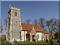
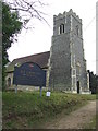
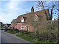
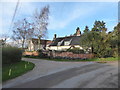
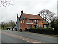
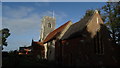
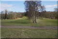
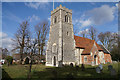
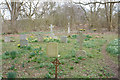
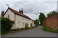
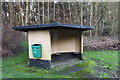
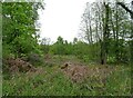
Photos of Bromeswell
Area Information
Bromeswell is a compact built-up area spanning 50.2 hectares, situated in England. With a median age of 70, the community here is predominantly older, reflecting a demographic profile that contrasts with more youthful urban centres. The area’s appeal lies in its practicality: 59% of homes are owner-occupied, suggesting a stable, long-term resident base. Daily life is shaped by proximity to essential services, including five railway stations within practical reach, such as Melton Railway Station. Retail options are similarly accessible, with Morrisons, Spar, and local co-ops offering convenience for residents. Bromeswell’s character is defined by its blend of modest infrastructure and quiet living, ideal for those prioritising safety, simplicity, and ease of access to transport. The presence of Faith Christian Academy, an independent school, adds a layer of educational choice for families. For buyers seeking a low-maintenance, secure environment with straightforward amenities, Bromeswell offers a straightforward, no-frills alternative to more densely populated areas.
- Area Type
- Built Up Area 250
- Area Size
- 50.2 hectares
- Population
- Not available
- Population Density
- Not available
Bromeswell’s lifestyle is shaped by its proximity to essential amenities. Retail options include Morrisons, The STR, Spar, and East of England Co-operative Co, providing access to groceries, convenience stores, and local services. Five railway stations, such as Melton Railway Station, offer easy travel for commuting or weekend excursions. While the data does not detail parks or leisure facilities, the availability of retail and transport hubs suggests a focus on functionality over leisure. The area’s character is defined by its simplicity: residents can meet daily needs without long journeys, though cultural or recreational options may require venturing further afield. This practical approach to living aligns with Bromeswell’s demographic profile, prioritising ease and efficiency.
Amenities
Schools
The nearest school to Bromeswell is Faith Christian Academy, an independent institution. No Ofsted rating is provided in the data, so its educational quality remains unspecified. Independent schools often cater to specific religious or philosophical preferences, which may align with the values of certain families. The presence of a single school in the area suggests limited options for local education, though the independent nature of Faith Christian Academy may offer specialised curricula or smaller class sizes. For families seeking non-state education, this school is a notable feature, but those requiring state-funded alternatives may need to look further afield. The data does not indicate other schools nearby, so Bromeswell’s educational landscape is narrowly defined.
| Rank | A + A* % | School | Type | Entry gender | Ages |
|---|---|---|---|---|---|
| 1 | N/A | Faith Christian Academy | independent | N/A | N/A |
Explore more schools in this area
Go to Schools tabDemographics
Bromeswell’s population is marked by a median age of 70, indicating a community skewed towards older adults. The most common age range is listed as “Age: Total,” suggesting aggregated data that does not specify subgroups. Home ownership stands at 59%, a figure that positions the area as moderately owner-occupied, though not overwhelmingly so. The data does not provide breakdowns for household composition, accommodation types, or ethnic diversity, but the “total” designations imply a broad, non-specific demographic profile. This lack of granularity means the area’s social fabric remains somewhat opaque in terms of generational mix or cultural diversity. However, the high home ownership rate and older median age suggest a population that values stability and established living conditions over transient or diverse community dynamics.
Household Size
Accommodation Type
Tenure
Ethnic Group
Religion
Household Composition
Age
Household Deprivation
NS-SEC
Explore more demographic insights in this area
Go to Demographics tabPlanning
Planning Constraints
- Crime RiskLocked