Area Overview for Brockdish
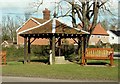
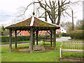
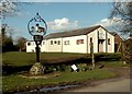
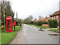
Photos of Brockdish
Area Information
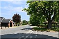
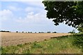
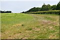
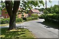
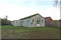
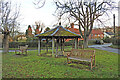
Living in Brockdish places you within a civil parish that encompasses just 9.1 km² of rural landscape in England. You will find yourself in a setting defined by quiet narrow lanes rather than the bustle of a market town or the sprawl of a major city. The area is small enough that you can traverse it quickly on foot or bicycle, yet it holds the characteristics of a traditional English countryside community. This parish offers a straightforward living environment where daily life revolves around local amenities rather than distant urban centres. You are freer from traffic congestion and noise pollution that characterises larger settlements. The limited land size means that the built-up area is compact, which reduces your commute times to local services. This layout suits those seeking a secluded lifestyle without being entirely cut off from the wider region. You will experience a slower pace of life where the natural environment takes precedence over commercial development. The distinctiveness of Brockdish lies in its preservation of open space and its lack of large-scale housing projects. It remains a place where you can hear the wind in the trees rather than the hum of factory machinery. This environment provides a stark contrast to the high-density housing found in nearby urban clusters.
- Area Type
- Parish
- Area Size
- 9.1 km²
- Population
- Not available
- Population Density
- Not available
Demographics
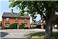
The community in Brockdish reflects a settlement designed for retirement or those who have completed their careers. You will find that the median age of residents is 70, which signals a predominantly elderly population. Most common age brackets skew heavily towards older cohorts, indicating that families with young children are not the primary demographic here. This age profile suggests a neighbourhood where neighbours are likely to be peers in terms of life stage and interests. Home ownership in Brockdish stands at 77 per cent, a figure that significantly exceeds the national average. This statistic confirms that the vast majority of residents own their properties outright or have substantial mortgages. You are looking at an area where people have chosen to settle down permanently rather than renting temporarily. The high ownership rate correlates with the older age demographic, as retirees often purchase homes to remain in after pension age. Household composition in the parish mirrors this stability, with fewer transient workers commuting through daily. The accommodation types present align with this pattern, favouring detached houses, bungalows, and period cottages common in historic rural parishes. Diversity metrics in Brockdish reflect the homogenous nature of many rural English villages.
Household Size
Accommodation Type
Tenure
Ethnic Group
Religion
Household Composition
Age
Household Deprivation
NS-SEC
Explore more demographic insights in this area
Go to Demographics tabPlanning
Planning Constraints
- Flood RiskPremium
- Ramsar Wetland SitesPremium
- Area of Outstanding Natural BeautyPremium
- Protected Nature ReservePremium
- Protected WoodlandPremium