Area Overview for Briston Ward
Photos of Briston Ward
Area Information
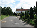
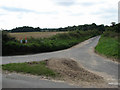
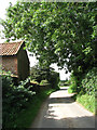
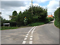
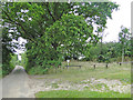
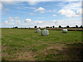
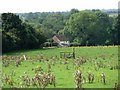
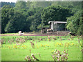
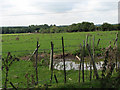
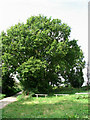
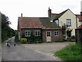
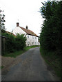
Briston Ward is a village and civil parish located in the North Norfolk district of Norfolk. It sits approximately 3.5 miles south-west of Holt and 19 miles north-west of Norwich. The ward covers an area of 12.0 km² and lies on the B1354 road between Thursford and Saxthorpe. Daily life here relies heavily on the local road network, with the nearest railway station located at Sheringham on the Bittern Line. This line connects residents to Norwich and Cromer, though access depends on the bus service running between Holt and Sheringham. Conventional car travel remains the primary method for reaching wider destinations. Norwich International Airport serves as the closest air link for those requiring air travel. The landscape includes open countryside typical of North Norfolk. Living in Briston Ward means navigating a rural setting where services are a short drive from Holt or Fakenham. The area functions as a distinct community within the East of England region. Its location makes it a quiet retreat for those who can manage the journey to larger towns for work or leisure. The ward boundaries reflect its identity as a self-contained locality rather than part of an urban sprawl. You will find yourself surrounded by the character of East Anglia without being next to a major city.
- Area Type
- District Borough Unitary Ward
- Area Size
- 12.0 km²
- Population
- Not available
- Population Density
- Not available
Demographics
The community in Briston Ward is defined by an older population profile. The median age stands at 70 years, indicating that residents are predominantly senior citizens. Most households in Briston Ward fall into the total age demographic, reflecting a mature environment. This age structure creates a quiet atmosphere with minimal noise or congestion from young families or commuters. Home ownership is the dominant form of tenure, with 70% of residents owning their properties outright or with a mortgage. This high level of ownership suggests long-term settlement rather than short-term renting. The ward lacks a diverse mix of age ranges, which shapes the social rhythm and available activities. You should expect a neighbourhood where neighbours likely know each other well due to the stability of residency. The accommodation and household composition data confirms that this is not a student town or a commuter belt for young professionals. Ethnic diversity and religious demographic data are not detailed in the available records, so the population remains homogeneous in its primary descriptors. Living in Briston Ward feels exclusive to an older demographic due to these specific age statistics. The environment prioritises the needs of retirees and established families over transient young households.
Household Size
Accommodation Type
Tenure
Ethnic Group
Religion
Household Composition
Age
Household Deprivation
NS-SEC
Explore more demographic insights in this area
Go to Demographics tabPlanning
Planning Constraints
- Flood RiskPremium
- Ramsar Wetland SitesPremium
- Area of Outstanding Natural BeautyPremium
- Protected Nature ReservePremium
- Protected WoodlandPremium
- Crime RiskPremium