Area Overview for Brickendon
Photos of Brickendon


Area Information
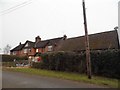
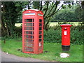
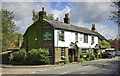
Brickendon is a compact built-up area in England, covering 27.3 hectares. Its population, though not explicitly stated, is reflected in its demographic profile, with a median age of 70, suggesting a community skewed towards older residents. Daily life here is shaped by proximity to essential services, including five railway stations within reach, such as Bayford and Hertford North. The area’s character is defined by its blend of practical amenities and accessible transport links, making it suitable for those prioritising convenience over sprawling urban sprawl. While the data does not specify population numbers, the high home ownership rate of 67% indicates a stable, long-term resident base. Brickendon’s appeal lies in its balance of quiet living and proximity to retail hubs like Tesco Waltham Cross and Aldi Hertford, ensuring residents have nearby access to essentials. The area’s compact size and established infrastructure cater to those seeking a settled lifestyle without the need for extensive travel.
- Area Type
- Built Up Area 250
- Area Size
- 27.3 hectares
- Population
- Not available
- Population Density
- Not available
Brickendon offers practical access to essential amenities, including five retail locations such as Tesco Waltham Cross, Sainsburys Broxbourne, and Aldi Hertford. These stores provide everyday shopping convenience, reducing the need for long journeys. While the data does not mention parks or leisure facilities, the proximity to rail stations and retail hubs suggests a lifestyle focused on accessibility and efficiency. The area’s compact nature means residents can reach key services quickly, supporting a routine centred on local needs. The presence of multiple supermarkets and the ease of rail travel contribute to a functional daily life, ideal for those prioritising convenience over expansive recreational spaces.
Amenities
Schools
| Rank | School | Type | Entry gender | Ages |
|---|
Explore more schools in this area
Go to Schools tabDemographics
Brickendon’s population has a median age of 70, the highest in the dataset, indicating a community predominantly composed of older adults. The most common age range is listed as “Age: Total,” suggesting a broad demographic spread, though specific breakdowns are absent. Home ownership is strong, with 67% of residents owning their homes, a figure that implies stability and long-term residency. The data does not specify household composition or accommodation types, but the overall “total” category for both suggests a mix of housing stock. The area’s demographic profile, while lacking detailed diversity metrics, aligns with a mature population, which may influence local services and amenities. This age profile could mean a focus on healthcare and community support services, though such details are not provided.
Household Size
Accommodation Type
Tenure
Ethnic Group
Religion
Household Composition
Age
Household Deprivation
NS-SEC
Explore more demographic insights in this area
Go to Demographics tabPlanning
Planning Constraints
- Crime RiskPremium