Area Overview for Bressingham & Burston Ward
Photos of Bressingham & Burston Ward
Area Information
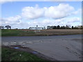
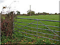
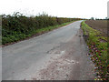
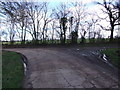
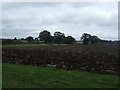
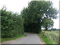
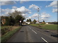
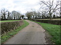
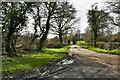
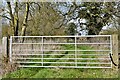
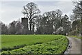
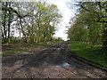
Living in Bressingham & Burston Ward offers a distinctly rural experience situated within the South Norfolk district of England. This electoral ward covers an expansive 73.8 km², blending the history of two villages, Bressingham and Burston, with the natural landscape of the region. You will find Bressingham positioned 2.1 miles north-west of Diss and 19 miles south-west of Norwich, always bisected by the A1066 road which links Thetford and Diss. The area is bordered to the south by the River Waveney, providing constant visual interest from your garden or walking path. Your daily life here is shaped by Anglo-Saxon legacy, as Bressingham was first mentioned in the Domesday Book of 1086. The community maintains a strong connection to its heritage through notable sites like the Grade I listed Church of St John the Baptist, dating from the late-13th century. Families seeking a village atmosphere have access to unique attractions such as the Bressingham Steam Museum and Gardens, established by Alan Bloom in the 1940s. You can explore narrow gauge railways or view the Dad's Army exhibition without leaving the local neighbourhood. The ward encapsulates a quiet pace of life where historical significance meets modern accessibility. While the A1066 provides a direct transport corridor, the rural setting ensures you remain connected to nature. Living here means embracing a specific blend of historical depth and contemporary rural living, anchored by landmarks that have defined the local character for over nine centuries.
- Area Type
- District Borough Unitary Ward
- Area Size
- 73.8 km²
- Population
- Not available
- Population Density
- Not available
Demographics
The community within Bressingham & Burston Ward is defined by a mature population profile, with a median age of 70 years old. This demographic data suggests you are joining a neighbourhood where generations have settled for the long term. The age structure indicates a significant presence of senior residents, shaping the local services and community activities to suit an older demographic profile. Home ownership stands at 79%, reflecting a stable environment where most residents have purchased their properties rather than renting. This high level of ownership typically contributes to lower turnover rates and a consistent community fabric. Consequently, the housing stock within Bressingham & Burston Ward likely prioritises long-term occupancy and maintenance of traditional village architecture. While the provided data does not break down household compositions or specific ethnic groups in detail, the overarching statistics point to a settled community nature. The high median age suggests that services and amenities cater primarily to families with older children and retirees. When considering homes in Bressingham & Burston Ward, you should anticipate a neighbourly atmosphere where stability is the norm. The 79% ownership rate implies that the majority of streets have long-term residents who understand the local pace of life.
Household Size
Accommodation Type
Tenure
Ethnic Group
Religion
Household Composition
Age
Household Deprivation
NS-SEC
Explore more demographic insights in this area
Go to Demographics tabPlanning
Planning Constraints
- Flood RiskPremium
- Ramsar Wetland SitesPremium
- Area of Outstanding Natural BeautyPremium
- Protected Nature ReservePremium