Area Overview for Brentwood West Ward
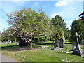
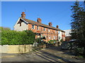
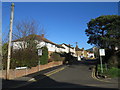
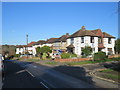
Photos of Brentwood West Ward


Area Information
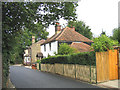
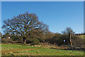
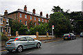
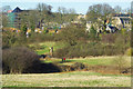
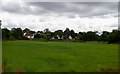
Living in Brentwood West Ward gives you access to a specific 1.5 km² district within the Brentwood district borough of Essex. This compact electoral ward sits at approximately 51.61874° N, 0.29674° E, covering postcode areas such as CM14 4BQ and CM14 4LQ along Common Road. The geography includes specific localities like Weald Road, placing the ward firmly within the Brentwood and Ongar parliamentary constituency. Daily life here is defined by its proximity to established infrastructure rather than generic suburbia. You are situated in a defined boundary that includes fixed postcode points at 51.615488, 0.301326 and 51.614953, 0.295593. This ward is not a sprawling city district but a focused area where every corner is known. The location serves as a residential node for the wider Eastern Region. Buyers looking for homes in Brentwood West Ward find a space that balances urban connectivity with the quieter feel of a ward boundary. The area is well documented in local government records, including future planning documents from the Brentwood council. You are not buying into an unknown development but into a mapped, understood section of town. The size is small enough for residents to know their neighbours, yet integrated enough into the borough to access wider services.
- Area Type
- District Borough Unitary Ward
- Area Size
- 1.5 km²
- Population
- Not available
- Population Density
- Not available
Demographics
The community in Brentwood West Ward has a median age of 70. This statistic means that older adults form the core of the population living in Brentwood West Ward. The data indicates that the most common age range is simply categorised as 'Total', suggesting the dataset aggregates all ages but confirms a high median. With 62% of residents owning their homes completely, the area is predominantly.owner-occupied rather than social housing or a rental market. Only 38% of households do not own their property outright, which is a lower figure than found in many commuter towns. The household composition data is recorded as 'Total', indicating the ward supports standard household structures for retirement or later life. Accommodation types are also aggregated under the label 'Total', but the high home ownership rate suggests a stable stock of long-term residences. Ethnic diversity and religious breakdowns are similarly grouped under 'Total' in the available records. The lack of specific breakdowns for these categories does not diminish the stability of the area. A community where nearly two-thirds of people own their homes usually indicates low tenant turnover. This environment supports the needs of a population where the average resident is over seven decades old. You are looking at a neighbourhood where stability and permanence are key features of daily life.
Household Size
Accommodation Type
Tenure
Ethnic Group
Religion
Household Composition
Age
Household Deprivation
NS-SEC
Explore more demographic insights in this area
Go to Demographics tabPlanning
Planning Constraints
- Flood RiskPremium
- Ramsar Wetland SitesPremium
- Area of Outstanding Natural BeautyPremium
- Protected Nature ReservePremium
- Protected WoodlandPremium
- Crime RiskPremium