Area Overview for Brentwood North Ward
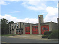
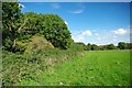
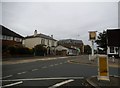
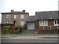
Photos of Brentwood North Ward
Area Information
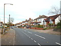
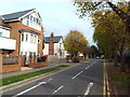
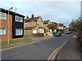
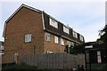
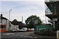
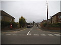
Living in Brentwood North Ward offers a defined living space within the broader Brentwood Borough Council area. This district borough unitary ward occupies approximately 1.7 square kilometres, providing a compact yet distinct neighbourhood for residents. The area is situated near the postcode CM14 4UQ, placing landmarks such as Honeypot Lane and Eald Close within its boundaries. Coordinates 51.624483, 0.298301 mark the central point of this ward, anchoring its location for anyone planning their commute or local routines. As a specific administrative division, Brentwood North Ward functions as a key unit within the local government structure, ensuring that residents have a clear geographical identity. The small footprint means distances between local amenities and homes are likely managed efficiently, reducing travel times for daily necessities. Prospective homebuyers often seek clarity on the exact location, and the specific naming of streets like Honeypot Lane helps distinguish this ward from its larger borough surroundings. The area represents a straightforward choice for those prioritising a well-defined locality within the wider commuter belt. Understanding the precise size and administrative status of 1.7 km² allows you to visualise the scale of daily life here without confusion. It is a practical choice for individuals who value a ranked system of governance and clear boundaries over a sprawling urban environment. The ward stands as a recognised entity on maps and official records, providing stability for those committing to living in the region.
- Area Type
- District Borough Unitary Ward
- Area Size
- 1.7 km²
- Population
- Not available
- Population Density
- Not available
Demographics
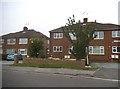
The community within Brentwood North Ward presents a clear demographic profile dominated by older residents. The median age of 70 indicates that the area is primarily suited for retirees or older families rather than young professionals or students. This age distribution suggests a quiet environment where daily life moves at a slower pace compared to younger neighbourhoods. Household composition and accommodation types are recorded as totals, reflecting the aggregated data available for this specific ward. Crucially, home ownership levels stand at 66%, a figure that significantly influences the character of the streets. With nearly two-thirds of residents owning their homes, the area feels stable and established rather than transient. This high rate of ownership typically correlates with long-term residents who have remained in the ward for decades. The lack of specific age range breakdowns means you must rely on this median figure to understand the social fabric, which centres around an older population. Reliability and continuity appear to be hallmarks here, driven by the decision of most people to buy rather than rent. For anyone considering moving to Brentwood North Ward, the demographic reality is that you will be joining a community defined by its older demographic and significant property ownership. The statistics show a society that has settled, with most households having secured their tenure through purchase years ago.
Household Size
Accommodation Type
Tenure
Ethnic Group
Religion
Household Composition
Age
Household Deprivation
NS-SEC
Explore more demographic insights in this area
Go to Demographics tabPlanning
Planning Constraints
- Flood RiskPremium
- Ramsar Wetland SitesPremium
- Area of Outstanding Natural BeautyPremium
- Protected Nature ReservePremium
- Protected WoodlandPremium