Area Overview for Breachwood Green
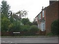
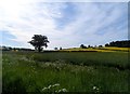
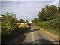
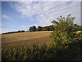
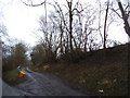
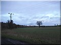
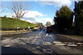
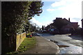
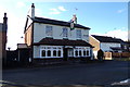
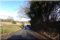
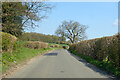
Photos of Breachwood Green

Area Information
Breachwood Green is a compact built-up area in England, spanning 22.6 hectares. Its population, while not explicitly stated, is reflected in its median age of 70, suggesting a community skewed toward older residents. The area is accessible via nearby rail networks, with stations at Luton Airport Parkway, Luton, and Harpenden, and within reach of London Luton Airport. This makes it a practical location for commuters or those needing frequent travel. The low crime risk score of 77/100 indicates a safer environment, though not without its challenges. Daily life here is shaped by proximity to retail hubs like Iceland Luton, Asda Luton, and M&S Luton Airport, as well as the presence of a primary school with a good Ofsted rating. While the area lacks detailed data on diversity or household composition, its 65% home ownership rate suggests a mix of long-term residents and renters. Breachwood Green is not a sprawling suburb but a focused, functional neighbourhood where convenience and connectivity are prioritised.
- Area Type
- Built Up Area 250
- Area Size
- 22.6 hectares
- Population
- Not available
- Population Density
- Not available
Breachwood Green’s lifestyle is shaped by its proximity to retail and transport hubs. Nearby stores include Iceland Luton, Asda Luton, and M&S Luton Airport SF, providing access to grocery and retail services. The area’s connection to London Luton Airport and multiple rail stations makes it convenient for travel, whether for business, leisure, or commuting. While the data does not mention parks or leisure facilities, the retail and transport options suggest a practical, service-oriented lifestyle. The presence of a primary school adds to the area’s appeal for families, though the broader amenity landscape remains focused on functional rather than recreational needs.
Amenities
Schools
Breachwood Green is served by Breachwood Green Junior Mixed and Infant School, a primary school with a good Ofsted rating. This institution caters to younger children, offering a foundation for families with school-age dependents. The absence of secondary schools in the data means that students may need to travel to nearby areas for further education. The presence of a well-rated primary school is a clear advantage for families prioritising early education, though the broader school ecosystem remains undefined. The school’s location within the area makes it a key factor for parents considering Breachwood Green, especially those seeking a reliable start to their children’s schooling.
| Rank | School | Type | Entry gender | Ages |
|---|
Explore more schools in this area
Go to Schools tabDemographics
The median age in Breachwood Green is 70, with the most common age range encompassing the total population. This indicates a community where older residents predominate, though the data does not specify whether this is due to an aging population or other factors. Home ownership stands at 65%, suggesting a significant portion of residents own their properties, while the remaining 35% may be renters or live in other tenure types. The accommodation types and household composition are not detailed in the data, so no assumptions can be made about family structures or housing diversity. Ethnicity and religion are also not specified, meaning the area’s cultural mix remains unquantified. The lack of specific figures on deprivation means its impact on quality of life cannot be assessed, but the low crime risk and proximity to amenities suggest a baseline of stability.
Household Size
Accommodation Type
Tenure
Ethnic Group
Religion
Household Composition
Age
Household Deprivation
NS-SEC
Explore more demographic insights in this area
Go to Demographics tabPlanning
Planning Constraints
- Crime RiskPremium