Area Overview for Brandon East Ward
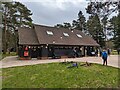
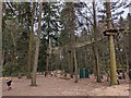
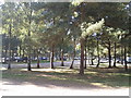
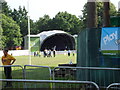
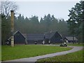
Photos of Brandon East Ward
Area Information
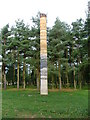
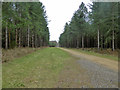
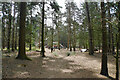
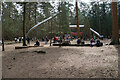
Living in Brandon East Ward means residing within a distinct electoral ward of West Suffolk Council in the heart of Suffolk. This district covers 20.5 km² and forms part of the broader Brandon electoral division alongside Brandon Central, Brandon West, and a small portion of Lakenheath Ward. Boundaries for this area were established in 2019, defining a clear community identity within the parish. The landscape is varied, incorporating specific named features such as Session Heath, Poors Plantation, Spruce Covert, and Broon Covert. These green spaces contribute to the character of the ward, offering residents access to local nature pockets like Mayday Far and Shakers Rand. Daily life here is situated within the East of England region, providing a balance between rural tranquillity and connection to the wider town of Brandon. The area represents a settled community where boundaries are well-defined and local governance operates through the Brandon Town Council. For those considering homes in Brandon East Ward, you are looking at a space defined by its administrative structure and its integration with surrounding parishes. The ward offers a specific slice of rural life that avoids being isolated from the main urban centre. Your view from a property here could well overlook one of the many named fields or coverts that define the local geography. This combination of specific boundaries and recognised green areas forms the backbone of the living experience for residents.
- Area Type
- District Borough Unitary Ward
- Area Size
- 20.5 km²
- Population
- Not available
- Population Density
- Not available
Demographics
The community profile of Brandon East Ward reflects a settled and stable population structure. Data indicates a median age of 70 for the ward, suggesting a significant proportion of older residents call the area home. This age profile often correlates with a desire for quiet spaces and established neighbourhoods rather than high-density developments. Over 86% of households in Brandon East Ward are owner-occupied. This high level of private ownership points to a community where many people have lived in their homes for extended periods, creating long-term roots within the ward. The accommodation stock supports this ownership model, with the majority of properties likely being single-family housing suitable for larger households or retired individuals. Ethnic diversity figures are presented as totals, indicating the official recognisation of a multicultural population alongside the predominant group. Religious affiliations are also recorded as totals, confirming that residents maintain cultural and spiritual traditions that contribute to the social fabric. There is no evidence suggests that the demographic makeup is shifting rapidly, which provides stability for those seeking a permanent place to live. The age distribution reinforces the idea that this is a destination for retirement or established families looking for a slower pace of life away from city centres.
Household Size
Accommodation Type
Tenure
Ethnic Group
Religion
Household Composition
Age
Household Deprivation
NS-SEC
Explore more demographic insights in this area
Go to Demographics tabPlanning
Planning Constraints
- Flood RiskPremium
- Ramsar Wetland SitesPremium
- Area of Outstanding Natural BeautyPremium
- Protected Nature ReservePremium
- Protected WoodlandPremium
- Crime RiskPremium