Area Overview for Brandon Central Ward
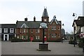
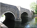
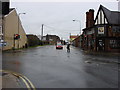
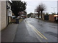
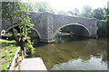
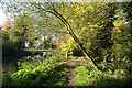
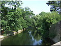
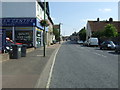
Photos of Brandon Central Ward


Area Information
Brandon Central Ward occupies a compact footprint of just 1.2 km² within the borough of Brandon. Living in this district means dealing with a very small geographical area that concentrates resident life into a tight neighbourhood. The ward presents itself as a settled community where daily routines unfold within a defined space. You will find that the settlement is primarily residential, designed for those seeking a location close to the town centre rather than sprawling suburbs. This central positioning ensures that essential services are likely within short walking distance for most households. The small size of the ward means that the community feels intimate and interconnected. There are no hidden corners here; everything is accessible without needing to travel far. This geographical constraint shapes the local identity and influences how residents interact with their immediate environment. When you consider homes in Brandon Central Ward, you are looking at a place where proximity matters more than amenity variety. The area serves as a functional hub for the wider borough, offering convenience over lifestyle luxury. Its status as a distinct ward unit provides clear boundaries for local governance and community engagement. Understanding the scale of this 1.2 km² area helps you grasp the intensity of life here. It is a place where the town centre surrounds you, making life practical and efficient.
- Area Type
- District Borough Unitary Ward
- Area Size
- 1.2 km²
- Population
- Not available
- Population Density
- Not available
Demographics
The community profile of Brandon Central Ward reflects a mature population with a median age of 70 years. This high age statistic indicates that the ward is home predominantly to older residents. You will live among a demographic that has likely been established in the area for decades. The age data suggests a lower proportion of young families or thirty-something professionals compared to other urban zones. Home ownership stands at 44%, meaning slightly less than half of the households own their properties. This figure leaves the remainder as rentals, indicating a mixed but predominantly owner-sited market for older demographics. The household composition and accommodation types follow a pattern consistent with an elderly population. Many households are likely single-occupancy or consist of couples living together. Ethnic diversity and religious affiliation data are rounded to a total figure, suggesting a homogenous demographic profile aligned with the area's age profile. The high median age directly influences the local_services demand, with a focus on healthcare and leisure suitable for seniors rather than schools or youth clubs. When evaluating living in Brandon Central Ward, you must prioritise accessibility and neighbourly support networks. The community relies on established routines and long-term neighbours who know each other well. This stability contrasts sharply with areas experiencing rapid population turnover or attraction to younger generations.
Household Size
Accommodation Type
Tenure
Ethnic Group
Religion
Household Composition
Age
Household Deprivation
NS-SEC
Explore more demographic insights in this area
Go to Demographics tabPlanning
Planning Constraints
- Flood RiskPremium
- Ramsar Wetland SitesPremium
- Area of Outstanding Natural BeautyPremium
- Protected Nature ReservePremium
- Protected WoodlandPremium
- Crime RiskPremium