Area Overview for Brancaster Staithe
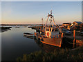
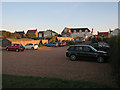
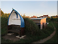
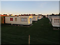
Photos of Brancaster Staithe
Area Information
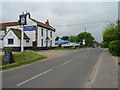
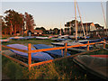
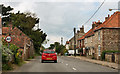
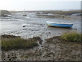
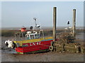
Brancaster Staithe is a compact built-up area in England, covering 52.9 hectares. Its population, while not explicitly stated, is reflected in its demographic profile, with a median age of 70, suggesting a community skewed toward older residents. The area’s size and character imply a quiet, low-density environment, likely with a strong sense of local identity. Safety is a key feature, with a crime risk score of 77, indicating below-average crime rates and a generally secure living environment. Daily life here is shaped by proximity to a Spar, offering basic retail needs within practical reach. The area’s appeal may lie in its tranquillity and the absence of high-density urban pressures, though its smaller footprint means amenities are limited to essentials. For those seeking a peaceful, low-crime location with a distinct community feel, Brancaster Staithe could be a compelling choice.
- Area Type
- Built Up Area 250
- Area Size
- 52.9 hectares
- Population
- Not available
- Population Density
- Not available
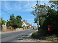
Residents of Brancaster Staithe have access to a Spar, offering essential retail services within practical reach. This local shop provides convenience for daily needs, though the absence of additional amenities like parks, dining, or leisure facilities suggests a minimalistic lifestyle. The area’s compact size means residents may need to travel further for more extensive services, but the Spar ensures basic provisions are available. The character of the area is likely defined by its simplicity and self-sufficiency, with a focus on essential living rather than vibrant commercial hubs. For those prioritising convenience over a wide range of amenities, this could be a practical advantage, though it may not suit those seeking a more dynamic or diverse lifestyle.
Amenities
Schools
| Rank | A + A* % | School | Type | Entry gender | Ages |
|---|
Explore more schools in this area
Go to Schools tabDemographics
The population of Brancaster Staithe has a median age of 70, with the most common age range encompassing all residents. This suggests a community predominantly composed of older individuals, which may influence local services and social dynamics. Home ownership stands at 67%, indicating a majority of residents live in properties they own rather than rent. The data does not specify household types or accommodation categories, but the overall figures suggest a stable, long-term resident base. The lack of detailed breakdowns on diversity or religion means broader demographic trends remain unclear. However, the high median age may imply a need for healthcare and community support services tailored to older adults, shaping the area’s character and priorities.
Household Size
Accommodation Type
Tenure
Ethnic Group
Religion
Household Composition
Age
Household Deprivation
NS-SEC
Explore more demographic insights in this area
Go to Demographics tabPlanning
Planning Constraints
- Crime RiskLocked