Area Overview for Braiseworth
Photos of Braiseworth
Area Information
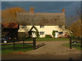
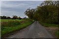
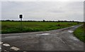
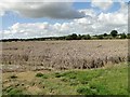
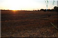
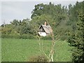
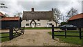
Braiseworth is a small, tight-knit civil parish covering 3.0 km² in England. It offers a quiet residential experience defined by its modest scale. You will find a community where residents know one another well, yet the area lacks the urban bustle found in larger towns. Daily life here focuses on simplicity and access to the immediate surroundings. The parish is compact, meaning distances to local facilities are short. This layout suits those who prefer a peaceful setting over a sprawling landscape. Living in Braiseworth means embracing a lifestyle where speed is not a priority. You travel fewer kilometres to reach your essentials compared to city dwellers. The environment supports a slower pace without sacrificing necessary amenities. This area serves as a calm retreat for those seeking stability.
- Area Type
- Parish
- Area Size
- 3.0 km²
- Population
- Not available
- Population Density
- Not available
Demographics
The population of Braiseworth reflects a mature community profile. The median age is 70 years, indicating a significant presence of retired residents. Most households consist of adults in the total age range, though the specific breakdown by younger demographics is not detailed in current records. A striking 82% of the population own their homes entirely. This high ownership rate suggests deep-rooted families and long-term residents rather than a transient workforce. The household composition data indicates that total household numbers span the full spectrum of family and single-person situations. Religious affiliations and predominant ethnic groups are recorded as available categories in the parish data. For anyone considering homes in Braiseworth, this is an older demographic stronghold. The community feels established and settled, rather than changing or developing rapidly.
Household Size
Accommodation Type
Tenure
Ethnic Group
Religion
Household Composition
Age
Household Deprivation
NS-SEC
Explore more demographic insights in this area
Go to Demographics tabPlanning
Planning Constraints
- Flood RiskPremium
- Ramsar Wetland SitesPremium
- Area of Outstanding Natural BeautyPremium
- Protected Nature ReservePremium
- Protected WoodlandPremium
- Crime RiskPremium