Area Overview for Bradwell-on-Sea
Photos of Bradwell-on-Sea

Area Information
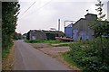
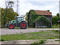
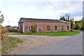
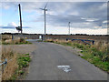
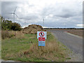
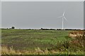
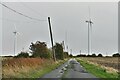
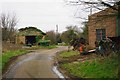
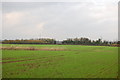
Bradwell-on-Sea sits as a distinct civil parish within the Maldon District of Essex, covering a total area of 34.6 km² along the Blackwater Estuary. The village defines itself through a profound historical connection to the past, anchored by the ruins of the Roman Saxon Shore fort Othona. This ancient site later transformed into an early Anglo-Saxon monastery and chapel, giving way to the Grade I listed Chapel of St Peter-on-the-Wall, dating to roughly 654 AD. You will find yourself in a location where modern life intersects with heritage, as the area encompasses not only this religious landmark but also the scheduled Saxon Shore fort and the location of one of Britain's oldest surviving churches. The parish remains relatively small in scale, which shapes the available infrastructure and community dynamics. While the core village feels historic, the surrounding environment includes protected nature reserves and Ramsar wetland sites, meaning development is naturally constrained. Living in Bradwell-on-Sea offers a setting defined by water and archaeology rather than commercial expansion. The postcode CM0 7HP serves the central area of the parish, linking residential zones to these significant historical assets. Your daily experience here involves proximity to estuarine landscapes and structures that have stood since the late 3rd century, providing a tangible link to the region's foundational history.
- Area Type
- Parish
- Area Size
- 34.6 km²
- Population
- Not available
- Population Density
- Not available
Demographics
The community profile of Bradwell-on-Sea reflects a settlement settled primarily by older adults, with a median age clustered at seventy years old. This demographic reality strongly influences the household composition and the types of lives lived within the parish boundaries. You will encounter a community where the majority of residents own their homes outright, with a home ownership rate standing at a solid 77 percent. This high figure suggests a stable population with a long-term commitment to the area, rather than a transient rental market. Those seeking homes in Bradwell-on-Sea are buying into an environment where neighbours have likely remained for decades. The accommodation mix, while officially recorded as a total category, supports this picture of senior living, likely comprising bungalows and smaller properties suited to reduced mobility or lifestyle changes. There is no data provided regarding specific deprivation indices or ethnic diversity breakdowns in the current records, so the public picture relies heavily on this age and ownership data. The result is a neighbourhood where quiet domesticity is the norm, and social life likely revolves around established institutions like the local chapel rather than modern entertainment hubs. If you are considering moving here, you must accept that the social fabric is woven by people in their seventh decade of life, prioritising stability and tradition.
Household Size
Accommodation Type
Tenure
Ethnic Group
Religion
Household Composition
Age
Household Deprivation
NS-SEC
Explore more demographic insights in this area
Go to Demographics tabPlanning
Planning Constraints
- Flood RiskPremium
- Ramsar Wetland SitesPremium
- Area of Outstanding Natural BeautyPremium
- Protected Nature ReservePremium
- Protected WoodlandPremium
- Crime RiskPremium