Area Overview for Booton
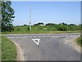
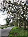
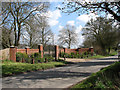
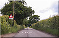
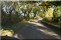
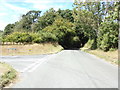
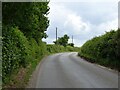
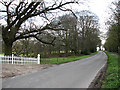
Photos of Booton

Area Information
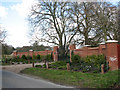
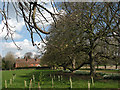
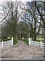
Living in Booton offers a distinctly rural experience within a civil parish that spans just 4.4 square kilometres. This small footprint defines the area's character, restricting dense development and preserving a quiet, village-focused lifestyle. You will find yourself in a settled environment where the lack of rings of steel and other major planning constraints helps maintain open spaces. The area passes assessments for flood risk, Ramsar wetland sites, Areas of Outstanding Natural Beauty, and protected woodland, indicating a landscape free from these specific high-risk designations. However, the presence of protected nature reserves is a noted consideration for anyone viewing plots here. Safety is a strong point for residents, with a crime risk score of 90 out of 100. This places Booton well below the national average for crime, ensuring a secure environment for families and retirees alike. The low crime risk score reflects a neighbourhood where safety is a primary daily concern for the community. When you look at Booton, you are looking at an area where the built environment has developed organically rather than through rapid urban expansion. The specific assessments confirm that while you must respect existing nature reserves, the broader planning situation is favourable for property stability. There are no immediate threats of designated protection that would halt development in ways that affect flood zones or major woodlands. This stability translates into a predictable living situation where the rules of the board are clear to all new residents. The area's size ensures that amenities are walkable or a short drive away, preventing the isolation that can affect larger, more remote rural parishes. For those considering homes in Booton, the small geographic area means every plot is part of a cohesive local loop. You do not have to navigate complex planning histories regarding nature conservation beyond the specific reserve alerts. The pass marks for flood and woodland protections give you confidence that the land underneath your future home is stable. You are buying into a safe, compact community where the risks are known and manageable. The absence of AONB designation means you have some flexibility regarding extensions and outbuildings compared to stricter conservation areas.
- Area Type
- Parish
- Area Size
- 4.4 km²
- Population
- Not available
- Population Density
- Not available
Demographics
The community in Booton reflects a settled, mature population with a median age of seventy years old. This demographic profile indicates an area dominated by older residents, likely retirees or those living out their later years in this peaceful setting. The data describes the most common age range as simply "Total," which signals a specific data limitation regarding granular age bracket breakdowns. Despite this, the high median age strongly suggests a low-energy, quiet atmosphere where younger families may be less prevalent. You can expect a neighbourhood where the pace of life is slower and social interactions are often rooted in long-standing local ties rather than transient student trends. Home ownership stands at a remarkable seventy-five percent within Booton. This high percentage confirms that the vast majority of properties are occupied by owners who have invested in their homes, creating a stable, owner-occupied market. The remaining twenty-five percent likely consists of lower-end purchasers or, less probably, long-term tenants in a small rental sector. Accommodation types are listed as "total" in the source data, meaning specific breakdowns of detached, semi-detached, or terrace houses are not available. However, the extremely high ownership rate often correlates with single-family homes in rural parishes. You do not need to worry about flighty landlords; the community is likely composed of people who intend to stay for the long haul. Ethnic diversity and religious affiliation data are unavailable in the provided records. Consequently, you cannot determine the predominant ethnic group or the primary religious denomination of the parish. This absence of specific diversity metrics suggests a homogeneous population, which is common in smaller, older English parishes. While you cannot confirm the exact religious make-up, the age demographic implies a community that may rely on established local traditions. For those concerned about community fit, the secure home ownership suggests a tight-knit social fabric. Residents invest in the village infrastructure and social clubs, fostering a sense of belonging that is less transient than in urban centres.
Household Size
Accommodation Type
Tenure
Ethnic Group
Religion
Household Composition
Age
Household Deprivation
NS-SEC
Explore more demographic insights in this area
Go to Demographics tabPlanning
Planning Constraints
- Flood RiskPremium
- Ramsar Wetland SitesPremium
- Area of Outstanding Natural BeautyPremium
- Protected Nature ReservePremium
- Protected WoodlandPremium
- Crime RiskPremium