Area Overview for Bocking North Ward
Photos of Bocking North Ward
Area Information
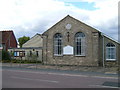
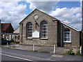
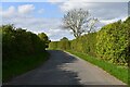
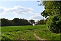
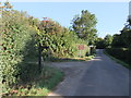
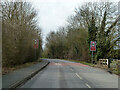
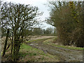
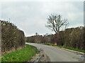
Bocking North Ward sits within Braintree District in Essex, covering an area of 14.6 km². It functions as the northern suburban part of Bocking village, positioned directly on the northern side of Braintree near the CM7 5YB postcode. This electoral ward forms part of the wider Braintree built-up area, historically divided between Bocking Churchstreet and Bocking along Bradford Street and The Causeway. Residents today enjoy a suburban environment described as a quiet village neighbouring a bustling market town. The location backs onto large open fields, providing immediate access to walks and nature. You can use these routes as a convenient cut-through to reach Halstead and Suffolk. The ward encompasses historic landmarks that define the local landscape, including the parish church with its ancient elements and Grade II listed Bocking Hall dating back to circa 1500. Bocking Windmill, a listed monument moved in 1829 and restored in 1962, stands as another key feature adjoing Braintree's shopping centre. Living in Bocking North Ward offers a blend of rural tranquillity and proximity to modern amenities. The community benefits from a strong sense of history, with the parish tracing its roots to East Saxon nobleman Aetheric in the 10th century. Note the Courtauld family's major silk industry establishment here from 1817, which shaped the local economic heritage. Sites include a historic workhouse that operated from the 1720s. You are close to the Freeport Braintree Village shopping centre while maintaining a rural feel within the suburban sprawl.
- Area Type
- District Borough Unitary Ward
- Area Size
- 14.6 km²
- Population
- Not available
- Population Density
- Not available
Demographics
The demographic profile of Bocking North Ward reveals a community dominated by an older population. The median age sits at 70 years, indicating a significant proportion of older residents compared to the national average. While the data categorises the most common age range broadly as 'Total', the high median age defines the character of the homes in Bocking North Ward. House ownership is a defining feature of this ward, with 67% of residents owning their properties outright or with a mortgage. This high rate of home ownership suggests a stable community rather than a transient rental market. The specific figures indicate that most households comprise those who have put down roots in this area. Accommodation types and household composition data confirm a settled population pattern, though detailed breakdowns of specific household sizes are not explicitly quantified beyond the total categories. The area remains diverse in terms of ethnicity and religion, with data reflecting the total population without highlighting any single predominant group overwhelmingly. This demographic makes Bocking North Ward particularly suitable for retirees or families seeking a quiet, established neighbourhood. The environment caters well to those who do not require a fast-paced urban setting. With nearly two-thirds of residents owning their homes, you will find a community deeply invested in the local development and public spaces. The age profile means local services are likely tailored to the needs of an older demographic.
Household Size
Accommodation Type
Tenure
Ethnic Group
Religion
Household Composition
Age
Household Deprivation
NS-SEC
Explore more demographic insights in this area
Go to Demographics tabPlanning
Planning Constraints
- Flood RiskPremium
- Ramsar Wetland SitesPremium
- Area of Outstanding Natural BeautyPremium
- Protected Nature ReservePremium
- Protected WoodlandPremium
- Crime RiskPremium