Area Overview for Bocking Blackwater Ward
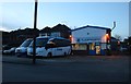
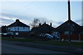
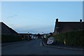
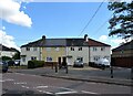
Photos of Bocking Blackwater Ward
Area Information
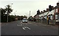
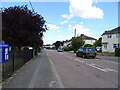
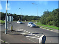
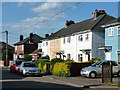
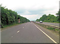
Bocking Blackwater Ward occupies just over 2.4 km² within Braintree District, forming a historic and compact district in Eastern England. This electoral ward, rebranded in 2024, encapsulates the core of the village of Bocking, including Churchstreet and its adjoining sections along the Blackwater River. Prospective residents find themselves in a location that sits on the left bank of the river, historically functioning as a suburb of Braintree. The area is anchored by significant historical landmarks such as St Mary's Deanery Church, a Grade I listed flint and limestone structure dating back to the 15th and 16th centuries, and Bocking Hall which adjoins the churchyard. Another point of interest is the Bocking Windmill, an 18th-century post mill restored in 1962 and currently open to the public. The community carries deep heritage, having hosted sit-down discussions of the Peasants' Revolt in 1381 and previously linking to the Archbishops of Canterbury as a peculiar parish. Living in Bocking Blackwater Ward means residing close to these preserved assets while situated within the Braintree built-up area. The modern ward postcode CM7 3TQ serves as a reference point for its location relative to the Blackwater River, offering a distinct blend of rural village charm and suburban integration.
- Area Type
- District Borough Unitary Ward
- Area Size
- 2.4 km²
- Population
- Not available
- Population Density
- Not available
Demographics
The community profile indicates a mature population, with a median age of 70 years. This high figure suggests that Bocking Blackwater Ward is primarily inhabited by older residents rather than families with young children or young professionals. Household composition data does not break down specific family types, but the age statistic strongly implies a retirement-oriented or retiree-heavy demographic. Home ownership stands at a significant 76%, indicating that the majority of residents own their properties outright or with a mortgage. This level of ownership suggests stability within the local community and a lower influx of short-term tenants compared to more transient districts. While specific breakdowns for ethnicity, religion, and predominant age ranges beyond the median are not detailed in the available records, the 76% home ownership rate provides a clear picture of tenure. The area attracts those seeking to settle for life, evidenced by the age profile and the high rate of ownership. You will find a neighbourhood where long-term residency is the norm, with the demographic skew towards the older generation. This makes the area particularly suitable for those with upcoming retirement considerations or family members living in their later years. The lack of data regarding specific ethnic diversity or religious breakdown requires focusing on the clear metrics of age and tenure which define the social structure here.
Household Size
Accommodation Type
Tenure
Ethnic Group
Religion
Household Composition
Age
Household Deprivation
NS-SEC
Explore more demographic insights in this area
Go to Demographics tabPlanning
Planning Constraints
- Flood RiskPremium
- Ramsar Wetland SitesPremium
- Area of Outstanding Natural BeautyPremium
- Protected Nature ReservePremium
- Crime RiskPremium