Area Overview for Bluehouse Ward
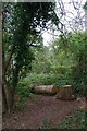
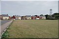
Photos of Bluehouse Ward


Area Information
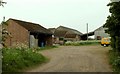
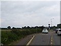
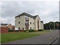
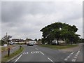
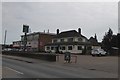
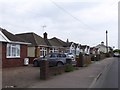
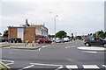
Bluehouse Ward is an electoral ward within Tendring District Council in Essex, located within the Clacton-on-Sea postcode area CO16 7HX. This specific district occupies a compact footprint of just 2.2 square kilometres, positioning it as a neighbourhood of focused residential density. The ward operates at coordinates 51.798213, 1.130103 and forms an integral part of the wider Clacton parliamentary constituency. Residents navigate a landscape defined by specific streets including Hampstead Avenue, Parry Drive, Gilders Way, Cottage Grove, Constable Avenue, and Saint John's Road. A key landmark within these boundaries is Cann Hall Primary School, which serves the immediate community of children. The area encompasses a population of approximately 1,353 individuals, creating a settlement that feels manageable and closely knit. Living in Bluehouse Ward means engaging with a locality that balances residential streets with essential nearby amenities. The ward's identity is rooted in its clear geographic definition and its role as a functional unit within the Tendring administrative structure. Prospective buyers find a defined space where the population size supports a quiet, focused living environment without the sprawling nature of larger urban districts. The area represents a clear segment of coastal Essex life, anchored by stable address patterns and established local institutions.
- Area Type
- District Borough Unitary Ward
- Area Size
- 2.2 km²
- Population
- Not available
- Population Density
- Not available
Demographics
The population profile of Bluehouse Ward reveals a community dominated by older residents. The median age within the ward is 70 years, indicating that a significant proportion of households are likely retired or nearing retirement age. This demographic skew suggests a lifestyle centred around established routines rather than young family expansion. While you might expect diverse household types in such a setting, the specific data available does not break down the composition into single-person or family-specific categories, so the precise mix remains general. Similarly, details regarding predominant ethnicity and religious affiliation are not detailed in the current statutory returns for this specific ward. Despite this, the area shows distinct patterns in housing tenure. Home ownership stands at 45%, meaning nearly half of the residents buy their property. This figure paints a picture of a balanced market where private ownership is prevalent but not universal. The remaining housing stock likely comprises rental properties or shared ownership arrangements common across Essex. With roughly one thousand three hundred people residing over such a small area, the community lacks the anonymity of major cities. The demographic reality points to a stable, long-term resident base where the median age of 70 years shapes the local character and service needs significantly.
Household Size
Accommodation Type
Tenure
Ethnic Group
Religion
Household Composition
Age
Household Deprivation
NS-SEC
Explore more demographic insights in this area
Go to Demographics tabPlanning
Planning Constraints
- Flood RiskPremium
- Ramsar Wetland SitesPremium
- Area of Outstanding Natural BeautyPremium
- Protected Nature ReservePremium
- Protected WoodlandPremium
- Crime RiskPremium