Area Overview for Bletsoe
Photos of Bletsoe
Area Information
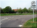
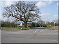
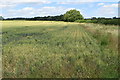
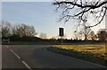
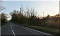
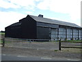
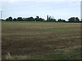
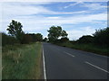
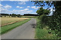
Bletsoe is a civil parish situated in Bedfordshire, lying on the A6 road approximately eight miles north of Bedford. This ancient settlement covers an area of 9.1 square kilometres, bounded by Riseley to the north and Sharnbrook to the west. The land rises from 153 feet at the A6 junction to 290 feet at Bourne End, creating a varied rural landscape. You will find a village community defined by its history, having been mentioned in the Domesday Book of 1086 with a population then exceeding 100. The current character reflects a shift from its agricultural roots, following urban migration in the mid-19th century. The parish includes notable features such as the parish church of St Mary the Virgin, which houses the St John Chapel and the Sir John St John Memorial from 1559. You may also encounter the former site of Bletsoe Castle, the birthplace of Margaret Beaufort. Residents enjoy access to a small local park, the village hall, and the war memorial. The nearby hamlet of Bourne End is also part of the parish. Living in Bletsoe offers a quiet village experience with established boundaries that have remained unchanged for over a century. The area sits within the Borough of Bedford council area, providing a distinct sense of place away from larger towns.
- Area Type
- Parish
- Area Size
- 9.1 km²
- Population
- Not available
- Population Density
- Not available
Demographics
The community in Bletsoe displays a clear demographic profile with a median age of 70 years. This indicates a population skewed significantly towards older residents compared to national averages. The data does not specify the most common age range beyond the total age count, reinforcing the dominance of the elderly demographic. Home ownership is the prevailing norm, with 74 percent of households in Bletsoe owning their property outright or with a mortgage. This high rate suggests stability within the community, as most residents have long-term roots in the parish. Accommodation types are not detailed by specific breakdowns beyond aggregate totals, but the high ownership rate implies a mix of family homes and single-dwelling properties suitable for retirees. The parish does not provide specific data on predominant ethnic groups or religious affiliations, so the community composition remains broad. You do not have detailed figures to assign to deprivation indices or quality of life metrics directly; however, the age profile of 70 hints at a community needing accessible amenities suited to older adults. The lack of a young population may mean fewer families with school-age children reside locally. When you look at household composition totals, the picture points to a less transient population.
Household Size
Accommodation Type
Tenure
Ethnic Group
Religion
Household Composition
Age
Household Deprivation
NS-SEC
Explore more demographic insights in this area
Go to Demographics tabPlanning
Planning Constraints
- Flood RiskPremium
- Ramsar Wetland SitesPremium
- Area of Outstanding Natural BeautyPremium
- Protected Nature ReservePremium
- Protected WoodlandPremium
- Crime RiskPremium