Area Overview for Bishop's Stortford All Saints Ward
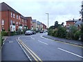
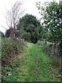
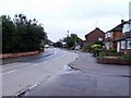
Photos of Bishop's Stortford All Saints Ward


Area Information
Living in Bishop's Stortford All Saints Ward offers a compact living experience within a very specific local boundary. You are situated in an area that covers just 2.0 km², meaning much of your daily life likely takes place within a short walk from your front door. This limited footprint distinguishes the ward from broader parts of the borough, creating a tight-knit environment where residents know their immediate neighbours. The demographics reveal a community with a median age of 70, suggesting this location caters primarily to an older demographic seeking a quieter lifestyle. Daily life in Bishop's Stortford All Saints Ward is defined by stability and long-term settlement rather than transient living. With a median age this high, you will find a neighbourly environment where community ties are often deep-rooted and longstanding. The ward functions as a quiet residential enclave rather than a commercial hub, offering peace to those who prioritise a calm surroundings over the bustle of a high street. For retirees or older couples, this concentration of similar-aged households can provide social comfort and a shared lifestyle. The small size of the ward means you can navigate the area easily, yet you remain well-connected to the wider amenities found in the main town of Bishop's Stortford. This community profile is heavily skewed towards older residents, with a median age of 70. You are looking at an area where three out of four households consist predominantly of older adults or retirees. This age distribution shapes the local culture, favouring services and amenities suitable for mature living rather than those targeting families with young children. Most residents are settled in forever homes rather than rental properties, evidenced by a home ownership rate of 62%. This high level of ownership indicates strong community stability and a population committed to their locality. The household composition reflects this settled nature, with the data showing a total category representing the general makeup of families in the ward. While specific breakdowns of single-person or multi-generational homes are not provided in the source material, the overwhelming median age suggests a demographic focused on later-life living. Dividity in the area is not highlighted by the available figures, which focus total counts on age and ownership rather than ethnic or religious breakdowns. This homogenous community feel can attract buyers seeking a like-minded environment where the majority of neighbours share similar life stages and priorities.
- Area Type
- District Borough Unitary Ward
- Area Size
- 2.0 km²
- Population
- Not available
- Population Density
- Not available
Demographics
Household Size
Accommodation Type
Tenure
Ethnic Group
Religion
Household Composition
Age
Household Deprivation
NS-SEC
Explore more demographic insights in this area
Go to Demographics tabPlanning
Planning Constraints
- Flood RiskPremium
- Ramsar Wetland SitesPremium
- Area of Outstanding Natural BeautyPremium
- Protected Nature ReservePremium
- Protected WoodlandPremium
- Crime RiskPremium