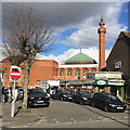
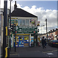
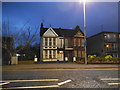
Area Overview for Biscot Ward
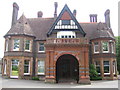
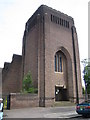
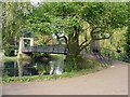
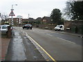
Photos of Biscot Ward


Area Information
Living in Biscot Ward offers a specific experience within the wider landscape of Luton Borough. You are looking at a unitary authority ward that forms part of the town of Luton, situated alongside wards such as High Town and Dallow Wards. The area covers a specific footprint of 93.5 hectares, creating a relatively compact environment where residents live close together. With a population density of 2061 people per square kilometre, the environment is neither sprawling nor densely packed in a high-rise sense, but rather sits at a moderate intensity suitable for local daily life. You will find the streets are defined by local roads like Biscot Road and paths such as the L274, which connect residents to nearby areas like Dorrington Close. This density ensures you are never truly isolated, yet the ward maintains a distinct identity as a residential zone rather than a commercial hub. The population stands at 1928, giving the neighbourhood a manageable scale where community interactions are more likely than in larger districts. You should consider how this size supports your lifestyle needs, particularly regarding length of commutes or local errands. Understanding the physical boundaries and population spread helps you visualise your future life in Biscot Ward. The ward is an integral piece of the Luton puzzle, functioning as a key residential district that connects wider borough networks with local routes.
- Area Type
- District Borough Unitary Ward
- Area Size
- 93.5 hectares
- Population
- 1928
- Population Density
- 2061 people/km²
Demographics
The community profile of Biscot Ward defines the daily rhythm you can expect when living in this area. Your neighbours will predominantly be older residents, as the median age for the population is exactly 70. This statistic indicates a significant concentration of individuals in their later years, which influences local services and social activities. You should not expect a high concentration of young families or students in this specific ward. Home ownership is a major factor here, with 52% of residents owning their homes outright or with a mortgage. This figure suggests that the area has a settled feel, as a majority of households have a vested interest in their local neighbourhood. Regarding household composition and accommodation types, the available data presents the ward as a standard residential mix. You will encounter a blend of properties typical for the district, though specific breakdowns between flats and houses are not detailed in the current statistics. The population of 1928 spread across the ward means that you are looking at a community where long-term residents are common. This demographic stability often leads to consistent local character. When you assess living in Biscot Ward, the age profile is the most defining feature. You are entering an area where the established population drives the local culture and the pace of life.
Household Size
Accommodation Type
Tenure
Ethnic Group
Religion
Household Composition
Age
Household Deprivation
NS-SEC
Explore more demographic insights in this area
Go to Demographics tabPlanning
Planning Constraints
- Flood RiskPremium
- Ramsar Wetland SitesPremium
- Area of Outstanding Natural BeautyPremium
- Protected Nature ReservePremium
- Protected WoodlandPremium
- Crime RiskPremium