Area Overview for Besthorpe
Photos of Besthorpe
Area Information
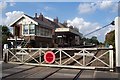
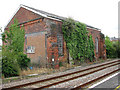
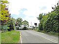
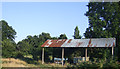
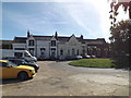
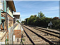
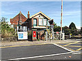
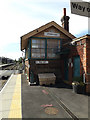
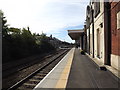
Living in Besthorpe offers a quiet, established presence in a compact built-up area spanning 28.6 hectares. The area’s character is defined by its mature population, with a median age of 70, suggesting a community rooted in long-term residency. Besthorpe is not a sprawling suburb but a focused neighbourhood, with homes clustered around practical amenities. For those prioritising safety, the area scores well, with a crime risk rating of 78/100 — below average, indicating a secure environment. Digital connectivity is near flawless, with a broadband score of 100, ensuring seamless internet access for work or leisure. Proximity to four railway stations, including Attleborough and Spooner Row, and a metro link to Wymondham Abbey, positions Besthorpe as a convenient base for commuters. The retail options, from Lidl to Sainsburys, and the presence of a petrol station, cater to daily needs without requiring long journeys. Besthorpe’s appeal lies in its balance of tranquillity, accessibility, and the reliability of its infrastructure, making it suitable for those seeking a stable, low-maintenance lifestyle.
- Area Type
- Built Up Area 250
- Area Size
- 28.6 hectares
- Population
- Not available
- Population Density
- Not available
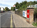
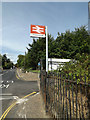
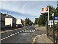
Residents of Besthorpe have access to a range of nearby amenities that support daily life. Retail options include Lidl in Attleborough, Sainsburys in Attleborough, and a BP service station in Besthorpe, ensuring groceries and fuel are within easy reach. The four railway stations — Attleborough, Spooner Row, Eccles Road — provide regular commuter links, while the metro connection to Wymondham Abbey opens up broader regional travel. Though the data does not list parks or leisure facilities, the presence of multiple retail and transport hubs suggests a focus on practicality over expansive recreational spaces. The area’s compact size means amenities are clustered, reducing travel time. For those prioritising convenience over large-scale leisure, Besthorpe’s proximity to shops, transport, and services creates a self-contained environment where daily needs are met without venturing far.
Amenities
Schools
| Rank | School | Type | Entry gender | Ages |
|---|
Explore more schools in this area
Go to Schools tabDemographics
Besthorpe’s population skews older, with a median age of 70, reflecting a community where long-term residents outnumber younger demographics. Home ownership is high, at 73%, suggesting a stable housing market with fewer rental properties. The data does not specify household composition or ethnic diversity, but the absence of detailed breakdowns implies a homogenous profile. The area’s accommodation types are not quantified, but the high ownership rate indicates a predominance of owner-occupied homes. This demographic profile shapes a neighbourhood where familiarity and continuity are key. For those considering Besthorpe, the age demographic may influence local services and social dynamics, with a focus on amenities catering to older residents. The lack of specific data on diversity or deprivation means the area’s inclusivity remains unexplored in this context.
Household Size
Accommodation Type
Tenure
Ethnic Group
Religion
Household Composition
Age
Household Deprivation
NS-SEC
Explore more demographic insights in this area
Go to Demographics tabPlanning
Planning Constraints
- Crime RiskPremium