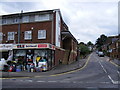
Area Overview for Berkhamsted
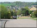
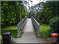
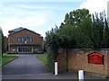
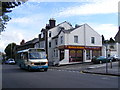
Photos of Berkhamsted


Area Information
Berkhamsted is a built-up area situated in England, covering a total size of 6.2 km². The local community numbers 4,785 residents, creating a neighbourhood with a population density of 774 people per square kilometre. This figure places Berkhamsted firmly within the category of a town or city in the broader English landscape, rather than a sprawling rural settlement. You will find a tightly knit community where daily interactions are shaped by proximity and established routines. The area functions as a traditional residential hub without the overwhelming pressures of a major metropolitan centre. Living in Berkhamsted offers a sense of stability derived from its defined boundaries and moderate population size. The environment is familiar, with local services concentrated within easy reach of homes. Residents navigate the area knowing the layout and the locations of local businesses. The population figure of 4,785 suggests a community where neighbours often know each other by name. This compact footprint allows for efficient access to the wider district while maintaining a distinct local character. The area represents a specific slice of Hertfordshire life, balancing accessibility with a quieter pace compared to larger urban centres.
- Area Type
- Built Up Area 250
- Area Size
- 6.2 km²
- Population
- 4785
- Population Density
- 774 people/km²
Shopping and retail options are concentrated and accessible, with five notable retail premises within practical reach. Budgens Berkhamsted offers everyday grocery necessities, while M&S Berkhamsted SF provides a selection of clothing and household goods. Waitrose Berkhamsted acts as a premium supermarket option for those seeking higher-end produce and baked goods. These three establishments form the core of the local shopping experience for residents living in Berkhamsted. The presence of these specific retailers ensures that daily errands require minimal travel. Transport links extend beyond local roads, with four railway Stations nearby facilitating movement by train. Berkhamsted Railway Station serves as the main departure point for daily commutes. Tring Railway Station and Hemel Hempstead Railway Station allow for extended journeys. One metro station, Chesham Underground Station, provides direct access to the Underground network. This integration of rail and tube options means you can travel from Berkhamsted to central London with minimal transfers. The balance of these amenities creates a convenient lifestyle where work, leisure, and shopping coexist within a short radius. You can combine a trip to Waitrose with a train journey to London seamlessly. The local high street experience is supported by these larger chain presences, ensuring quality services without the isolation of a rural village.
Amenities
Schools
Families considering schools near Berkhamsted have several options within practical reach, though the local median age suggests a lower immediate demand for primary places. You can find five primary schools operating in the vicinity, each with distinct Ofsted ratings. Swing Gate Infant School and Nursery holds a good rating and serves the growing needs of younger children. Greenway Primary and Nursery School also carries a good rating, offering parents a reliable educational choice nearby. St Mary's CofE Primary School, located in Northchurch, is another option operating under a good rating. This school provides faith-based education for students in the area. Westfield Primary School and Victoria Church of England Infant and Nursery School both hold satisfactory ratings. These establishments offer a range of educational approaches, from infant-focused teaching to combined primary units. The mix of ratings indicates a generally stable educational environment, with three schools achieving a good rating. However, two schools currently carry a satisfactory rating, which suggests these institutions are working through specific improvement targets identified by inspectors. For parents living in Berkhamsted, the presence of multiple primaries ensures that no single school dominates the local intake. The variety allows families to choose based on specific educational philosophies or proximity to their homes.
| Rank | School | Type | Entry gender | Ages |
|---|
Explore more schools in this area
Go to Schools tabDemographics
The community profile of Berkhamsted reveals a distinct age profile with a median age of 70 years. This statistic indicates that the resident population leans heavily towards older demographics, suggesting families with young children represent a smaller portion of the total population. The data confirms this trend across the entire age breakdown, identifying age as the total most common range factor. You should expect a quieter atmosphere where retirement living and mature households dominate the street scene. Home ownership stands at 74%, which means the majority of residents own their properties outright or have a significant equity stake. This high rate suggests the area has historically appealed to those seeking long-term stability rather than short-term rental arrangements. Ownership levels directly influence the type of community that develops, often fostering a strong sense of neighbourhood investment and pride in property maintenance. The accommodation types reflect this tenure, with owner-occupied stock forming the backbone of the local housing stock. Ethnic diversity and religious composition are recorded as total categories in the available records, meaning specific breakdowns are not detailed in the current data. However, the dominance of home ownership and the high median age point towards a community that values established living arrangements. This demographic structure influences local demand for large homes or properties with maintenance considerations suitable for older residents.
Household Size
Accommodation Type
Tenure
Ethnic Group
Religion
Household Composition
Age
Household Deprivation
NS-SEC
Explore more demographic insights in this area
Go to Demographics tabPlanning
Planning Constraints
- Crime RiskPremium