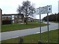
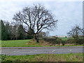
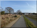
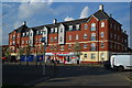
Area Overview for Berechurch
Photos of Berechurch

Area Information
Living in Berechurch offers a specific experience defined by its small scale and distinct character. This built-up area covers exactly 1.7 km², creating a compact environment where local life is centred on the immediate surroundings. The community is situated in England and functions as a recognised residential zone rather than a sprawling town. You will find that daily life here involves a mix of quiet residential streets and access to nearby transport links. The area attracts residents who value proximity to rail stations and local shopping options without the density of a larger city centre. Your daily routine in Berechurch likely involves walking or driving short distances to essential services. The limited land size means that amenities, schools, and transport hubs are within practical reach for most households. This layout suits families who prefer a contained living environment over extensive urban sprawl. You should expect a neighbourly atmosphere where the local footprint influences social interactions and community activities. The area provides a clear definition of what it means to live in a specific English settlement, balancing isolation with accessibility.
- Area Type
- Built Up Area 250
- Area Size
- 1.7 km²
- Population
- Not available
- Population Density
- Not available
Your lifestyle in Berechurch is supported by a range of practical amenities located within practical reach. Retail options are readily available, with Morrisons Daily, Spar, and Lidl on Abbots Road forming the core of shopping provision. These five local stores offer groceries and daily essentials without the need for lengthy commutes. For those needing to travel further, five rail connections are accessible, including Colchester Town Railway Station, Hythe Railway Station, and Wivenhoe Railway Station. This rail network provides swift access to wider counties and employment hubs. Boating enthusiasts can utilise the East Mersea Ferry Landing for leisure travel across the water. The presence of this ferry service adds a unique holiday option for weekend trips. With five notable retail outlets and multiple railway stations nearby, daily conveniences are front and centre. You can complete shopping runs in minutes rather than hours. The integration of rail and river transport diversifies the ways you can leave the area for leisure or business. This blend of immediate shops and regional transport links ensures that living in Berechurch does not feel isolated. Your weekly routine will be shaped by the ease of reaching these specific facilities without major planning.
Amenities
Schools
Families living in or near Berechurch have access to two named educational institutions that serve the local community. The nearest primary education is provided by Cherry Tree Primary School and Speech and Language Unit, offering special support for young learners. For secondary education, Cherry Tree Academy stands as the key provider for older students. This academy holds an Ofsted rating of good, a standard that assures parents of maintained quality in teaching and student outcomes. The proximity of these specific schools means you do not need to travel far for your children's education. Having a primary school with dedicated speech and language support alongside an academy with a good rating creates a complete local educational route. This mix of a specialist primary unit and a well-regarded academy simplifies choices for parents residing in the zone. You can feel confident that the schooling options available directly serve the neighbourhood without requiring significant relocation. The presence of these two named institutions underpins the area's suitability for families who prioritize educational access close to their homes.
| Rank | A + A* % | School | Type | Entry gender | Ages |
|---|---|---|---|---|---|
| 1 | N/A | Cherry Tree Primary School and Speech and Language Unit | primary | N/A | N/A |
| 2 | N/A | Cherry Tree Academy | academy | N/A | N/A |
Explore more schools in this area
Go to Schools tabDemographics
The community in Berechurch reflects a settled population with distinct demographic characteristics. A significant 61% of residents are home owners, indicating a strong tradition of long-term tenure in this locality. The median age stands at 70 years, which places this area among the older settlements in the region. This age profile suggests that the housing stock caters primarily to retirees or older generations who have built their lives in the area. While specific data on household composition and predominant ethnic groups is not detailed, the high percentage of home ownership confirms a stable resident base. Your understanding of the community should focus on this older demographic and the resulting patterns of local engagement. The concentration of older residents often correlates with quieter neighbourhoods and gardens that have matured over decades. You will notice that the area has not seen recent large-scale migration or a youth influx typical of growing student towns. The demographic reality means that schools may face population pressures if nearby areas undergo demographic shifts, but currently, the local profile remains consistent with past decades. Home ownership drives the economic stability of these households, creating a community focused on permanence rather than transient living arrangements.
Household Size
Accommodation Type
Tenure
Ethnic Group
Religion
Household Composition
Age
Household Deprivation
NS-SEC
Explore more demographic insights in this area
Go to Demographics tabPlanning
Planning Constraints
- Crime RiskLocked