Area Overview for Bennetts End Ward
Photos of Bennetts End Ward
Area Information
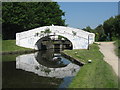
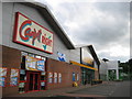
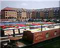
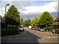
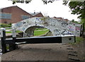
Bennetts End Ward sits in the southeast of Hemel Hempstead, forming a distinct district within the Borough of Dacorum. This 1.1 km² locality forms part of a larger masterplan that began construction in 1951, making it a core component of the new town development. You will find mostly public housing built in the 1950s, reflecting a planned community approach to post-war living. The area covers the HP3 postcode district and falls under the Hemel Hempstead County Constituency. History plays a visible role in the street names, particularly around Tile Kiln Lane and Kiln Ground, which recall the medieval tile and brick making industry that once characterised the farmland here. A curved terrace known as Long John stands out as a notable architectural feature, designed by Geoffrey Jellicoe and partners in a Georgian style. Today, the Bennetts Gate neighbourhood shopping centre serves as a local hub, having opened in 1954 to replace mobile vans that previously served the district. While it faces competition from the main town centre, it remains an integral part of daily life for residents living in Bennetts End Ward.
- Area Type
- District Borough Unitary Ward
- Area Size
- 1.1 km²
- Population
- Not available
- Population Density
- Not available
Demographics
The community profile of Bennetts End Ward is defined by a significant senior population. The median age stands at 70 years, indicating that older adults make up the core of the resident base. Household composition data categorises the total population without a specified breakdown of single-person or family units in the provided figures. Home ownership is present at 62% of households, suggesting a mixture of owners and tenants within the ward. As this is a designated ward within Hemel Hempstead, the demographic landscape reflects the area's long-term social housing origins. The population data points to a stable, established community rather than a transient one. You are looking at an area where life pace likely aligns with the needs of a mature demographic. The ethnic makeup, religious affiliations, and predominant group data are recorded as totals, suggesting a homogenous or unbroken community structure. This profile creates a specific environment where services and social norms cater primarily to older generations seeking quiet, stable neighbourhoods.
Household Size
Accommodation Type
Tenure
Ethnic Group
Religion
Household Composition
Age
Household Deprivation
NS-SEC
Explore more demographic insights in this area
Go to Demographics tabPlanning
Planning Constraints
- Flood RiskPremium
- Ramsar Wetland SitesPremium
- Area of Outstanding Natural BeautyPremium
- Protected Nature ReservePremium
- Protected WoodlandPremium
- Crime RiskPremium