Area Overview for Benhall Green
Photos of Benhall Green


Area Information
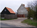
Benhall Green is a compact built-up area in England, spanning 24.1 hectares. Its small size and established character make it a quiet, focused community. The median age of 70 suggests a population skewed towards older residents, which may influence the pace of daily life. Despite its modest size, the area is well-connected to essential services, including five retail outlets and multiple rail stations, ensuring practical access to shopping and transport. Broadband quality scores at 83, reflecting reliable digital connectivity. This makes Benhall Green appealing for those prioritising ease of access to amenities and a low-crime environment. The presence of two primary schools nearby further cements its appeal for families. While the area’s older demographic may mean a more sedate atmosphere, the combination of safety, proximity to services, and established infrastructure creates a distinct niche for those seeking a stable, low-maintenance lifestyle.
- Area Type
- Built Up Area 250
- Area Size
- 24.1 hectares
- Population
- Not available
- Population Density
- Not available
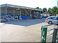
Residents of Benhall Green benefit from nearby amenities, including five retail outlets such as Tesco Saxmundham, Waitrose Saxmundham, and the East of England Co-operative. These shops provide essential shopping options, reducing the need to travel further for groceries or daily necessities. The rail stations within the area, including Saxmundham Railway Station, offer access to broader transport networks. While the data does not mention parks or leisure facilities, the proximity to retail and transport hubs suggests a lifestyle focused on practicality and convenience. The combination of local shopping and rail connectivity supports a self-sufficient, community-oriented daily life.
Amenities
Schools
Residents of Benhall Green have access to two primary schools: Benhall St Mary’s Church of England Voluntary Controlled Primary School and Benhall St Mary’s Church of England Primary School. Both institutions serve the local community, though the data does not include Ofsted ratings or academic performance metrics. The presence of two primary schools suggests a focus on local education, potentially reducing the need for long commutes for younger families. However, without specific details on school quality or capacity, prospective buyers must conduct further research to assess educational standards. The dual availability of primary schools may benefit families with multiple children, offering flexibility in school choice.
| Rank | School | Type | Entry gender | Ages |
|---|---|---|---|---|
| 1 | Benhall St Mary's Church of England Voluntary Controlled Primary School | primary | N/A | N/A |
| 2 | Benhall St Mary's Church of England Primary School | primary | N/A | N/A |
Explore more schools in this area
Go to Schools tabDemographics
The population of Benhall Green has a median age of 70, indicating a community predominantly composed of older adults. Home ownership is high, with 78% of residents owning their properties, suggesting a long-term presence of local families and individuals. The data does not specify household composition or diversity, but the high home ownership rate implies a stable, settled population. The absence of detailed breakdowns on accommodation types or ethnic diversity means the area’s social fabric remains partially opaque. However, the low crime risk score of 90/100 underscores a safe environment, which may align with the needs of older residents. The lack of specific data on deprivation or income levels means quality of life factors remain unquantified, though the overall profile hints at a community prioritising security and familiarity over rapid change.
Household Size
Accommodation Type
Tenure
Ethnic Group
Religion
Household Composition
Age
Household Deprivation
NS-SEC
Explore more demographic insights in this area
Go to Demographics tabPlanning
Planning Constraints
- Crime RiskPremium