Area Overview for Belfairs Ward
Photos of Belfairs Ward
Area Information
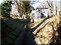
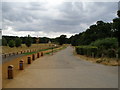
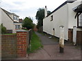
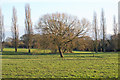
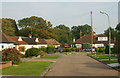
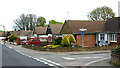
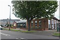
Belfairs Ward is an electoral ward within Southend-on-Sea City Council, situated on the north side of the Thames Estuary. The district is approximately 40 miles east of central London. You live in a compact area covering 2.6 square kilometres. This ward represents a specific pocket within the broader unitary authority of Southend-on-Sea. The location defines a distinct segment of the south-eastern Essex housing market. Daily life here revolves around a defined geographical boundary rather than sprawling development. You are looking at a settled environment with clear administrative boundaries. The ward identity is grounded in its status as a formal unitary borough ward. Residents appreciate the defined nature of the locality. The area size ensures close proximity between amenities and the street. You need to know this is a small, focused community within a larger city structure. The ward map clearly delineates where you call home. This specific jurisdiction holds official authority for local services in this sector of Essex. You are settled in a place with clear political and administrative resonance. The ward serves as a fundamental building block of the Southend urban landscape.
- Area Type
- District Borough Unitary Ward
- Area Size
- 2.6 km²
- Population
- Not available
- Population Density
- Not available
Demographics
The people living in Belfairs Ward have a well-established demographic profile characterised by significant owner occupation. Home ownership levels stand at 77 per cent across the ward. This high figure indicates a community where residents often have a long-term stake in their local properties. The population generally skews older, with a median age of 70 years. You will encounter a neighbourhood where long-term residents dominate the resident roll. The most common age grouping reflects this senior demographic shift. Unlike many modern development zones, you are not looking at a young professional hub. Instead, you face a mature community with established household dynamics. The ward contains a mix of accommodation types, though specific breakdowns by tenure are aggregated in total figures. This stability contrasts with rapidly changing districts where population churn is high. The ethnic and religious compositions follow total ward records. Deprivation levels correlate with this stability, suggesting a consistent quality of life for occupants. A two-person household might find plenty here. The age profile dictates the social rhythm of daily life in Belfairs Ward. You buy into a neighbourhood where retirement living is common. The data confirms a settled, age-specific community without significant generational mixing.
Household Size
Accommodation Type
Tenure
Ethnic Group
Religion
Household Composition
Age
Household Deprivation
NS-SEC
Explore more demographic insights in this area
Go to Demographics tabPlanning
Planning Constraints
- Flood RiskPremium
- Ramsar Wetland SitesPremium
- Area of Outstanding Natural BeautyPremium
- Protected Nature ReservePremium
- Protected WoodlandPremium
- Crime RiskPremium