Area Overview for Belchamp St. Paul
Photos of Belchamp St. Paul

Area Information
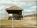
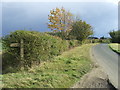
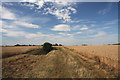
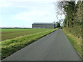
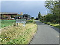
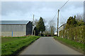
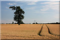
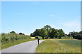
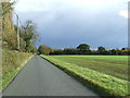
Belchamp St. Paul is a civil parish and village situated in the Braintree district of Essex, covering an area of 10.2 km². The community sits five miles west of Sudbury, Suffolk, defined by chestnut tree-lined lanes that wind past vast arable fields. This setting reflects the location's role within Essex's fertile breadbasket, where wheat and barley dominate the surrounding landscape. History permeates the daily life here, with the village rooted in agriculture since King Athelstan granted the manor in 930 AD. A wing of Paul's Hall, the former home of Arthur Golding, stands alongside the prominent St Andrew's Church, which was rebuilt in the late 15th century. You will find pleasant houses surrounding the village green, interspersed with 17th-century farms and ancient trees that evoke a traditional agricultural atmosphere. Living in Belchamp St. Paul means embracing a quiet, linear village strung along a main lane, far removed from the pace of the county towns. The environment feels timeless, anchored by historical monuments and the natural openness of the countryside. This distinct character attracts those seeking a settlement where the past remains visibly intertwined with modern rural living.
- Area Type
- Parish
- Area Size
- 10.2 km²
- Population
- Not available
- Population Density
- Not available
Demographics
The community in Belchamp St. Paul presents a distinctly older demographic profile compared to the national average. The median age stands at 70, indicating that the population is heavily skewed towards the retired and mature age groups. While the specific distribution across all age ranges is not detailed, the high median suggests a settlement where life often slows down. Home ownership seals the impression of a settled population, with 76% of households owning their homes outright. This high rate of ownership typically correlates with long-term residency and the retention of the area's architectural character. The composition of households and the types of accommodation present reflect this static demographic, although precise figures for household make-up and accommodation styles are not provided in the available records. You can expect a neighbourhood where residents value stability, evident in the vast majority owning their properties. Deprivation data is not included in the current profile, but the low crime risk and established nature of the village suggest a stable quality of life. The ethnic diversity and religious makeup are noted as aggregate totals in the data, pointing to a generally homogenous population typical of historic Essex villages.
Household Size
Accommodation Type
Tenure
Ethnic Group
Religion
Household Composition
Age
Household Deprivation
NS-SEC
Explore more demographic insights in this area
Go to Demographics tabPlanning
Planning Constraints
- Flood RiskLocked
- Ramsar Wetland SitesLocked
- Area of Outstanding Natural BeautyLocked
- Protected Nature ReserveLocked
- Protected WoodlandLocked
- Crime RiskLocked