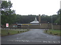
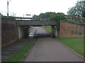
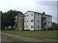
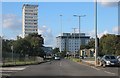
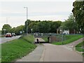
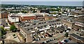
Area Overview for Bedwell Ward
Photos of Bedwell Ward


Area Information
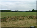
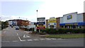
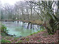
Bedwell Ward is an established residential area within the town of Stevenage, located in Hertfordshire, England. As one of the earliest wards constructed during the 1950s, it holds a significant place in Stevenage's history as a designated New Town following the Second World War. The ward spans an area of just 1.7 km², making it a compact yet substantial district. It sits closer to Stevenage Town Centre than some surrounding areas, offering convenient access to local amenities while maintaining a distinct residential character. Positioned in the eastern English region within the North Hertfordshire administrative area, Bedwell represents the foundational layers of a town that has grown significantly since its inception. The ward is subdivided into four sections, which adds variety to the residential experience while keeping the community cohesive. Living in Bedwell Ward means residing in one of the original built-up zones of Stevenage, an environment that has evolved alongside the city yet retains its historical footprint. This early development status contributes to a settled atmosphere, where the local infrastructure was designed for the lifestyle needs of the mid-20th century. For anyone considering homes in Bedwell Ward, understanding this timeline provides essential context about the layout, property ages, and future development potential inherent to this specific pocket of Stevenage.
- Area Type
- District Borough Unitary Ward
- Area Size
- 1.7 km²
- Population
- Not available
- Population Density
- Not available
Demographics
The community profile of Bedwell Ward reflects a distinct life stage, with a median age of 70 years. This demographic indicates that the area is home to a predominantly older population, which contrasts with many suburban developments targeting families or young professionals. The household composition and accommodation types have not been specified in the available records, leaving the exact split between singles, couples, and larger families unknown. However, the home ownership level provides a clear metric of community stability; 47% of residents own their homes outright. This figure suggests that nearly half of the population has a significant financial stake in the area, while the remaining 53% likely reside in rental properties or through other tenure types. Regarding diversity, the predominant ethnic group, religious affiliation, and specific deprivation data are not included in the current information set. Consequently, any analysis of cultural vibrancy or economic hardship indices must rely on broader trends for Stevenage rather than precise local figures. The high median age suggests a quieter, perhaps more settled neighbourhood where daily life revolves around different needs than in younger areas. Buyers considering living in Bedwell Ward should be prepared for a community geared towards retirees or senior residents, which influences local services and social activities even if exact casualty details remain unseen in this dataset.
Household Size
Accommodation Type
Tenure
Ethnic Group
Religion
Household Composition
Age
Household Deprivation
NS-SEC
Explore more demographic insights in this area
Go to Demographics tabPlanning
Planning Constraints
- Flood RiskPremium
- Ramsar Wetland SitesPremium
- Area of Outstanding Natural BeautyPremium
- Protected Nature ReservePremium
- Protected WoodlandPremium
- Crime RiskPremium