Area Overview for Beccles & Worlingham Ward
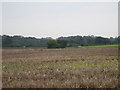
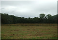
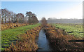
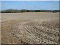
Photos of Beccles & Worlingham Ward


Area Information
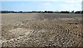
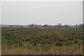
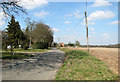
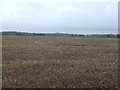
Beccles & Worlingham Ward is a distinct district within the borough unitary authority of Suffolk, covering an area of 24.6 square kilometres. You will find a population of 3,283 residents living here, creating a community that feels intimate rather than urban. The landscape supports a density of 133 people per square kilometre, suggesting a spread-out residential area rather than a crowded town centre. This ward offers a quiet living environment where you are likely to know your neighbours if you choose to stay long enough to build those relationships. Daily life in Beccles & Worlingham Ward revolves around a stable, established community. The area attracts retirees and established families who value space and a lower pace of life. With a median age of 70 years, the demographic strongly suggests this is a retirement-focused zone. Homeownership stands at 68 per cent, meaning most habits and residents have deep roots in these specific streets. If you are looking for homes in Beccles & Worlingham Ward, you are entering a market defined by permanence rather than transient living. The ward contains protected natural features alongside residential zones. You will find Ramsar wetland sites and protected nature reserves within the 24.6 square kilometre boundary. These designations influence local planning and the visual character of the neighbourhood, ensuring continued green spaces. Living in Beccles & Worlingham Ward means you are fortunate enough to have these preserved landscapes as part of your immediate environment. The area remains relatively small, allowing for a manageable sense of community without the anonymity of larger urban centres.
- Area Type
- District Borough Unitary Ward
- Area Size
- 24.6 km²
- Population
- 3283
- Population Density
- 133 people/km²
Demographics
The community in Beccles & Worlingham Ward has a very clear age profile, with a median age of 70 years. This figure explicitly points to a retirement-oriented population where older adults dominate the resident base. The most common age range category listed as "Total" does not provide a specific numeric split, but the high median confirms that families with young children are not the primary demographic. You should expect a quieter atmosphere with fewer school-age children or noisy adolescents in the evenings. Homeownership in Beccles & Worlingham Ward stands at 68 per cent. This high rate indicates that the majority of residents have purchased their properties and are not in a rental situation. A two-thirds ownership rate suggests stability, with people likely living in their homes for decades rather than moving frequently. This demographic characteristic often correlates with lower turnover in the housing market and a neighbours who have established long-term connections. If you are considering buying a home here, you will be joining a community of owners who have already navigated the purchase process. The available household composition and accommodation type data are listed as "total" without a specific breakdown of single-person versus family units. However, the median age of 70 years influences the type of housing stock required, likely favouring single-story bungalows or converted buildings suitable for mobility needs. Diversity, religion, and ethnicity data are similarly recorded as "total" metrics without specific demographic splits. Given the age profile, you will find an established, settled population. This area is not known for rapid demographic shifts or a transient workforce, making it predictable for those who value a stable neighbourhood environment.
Household Size
Accommodation Type
Tenure
Ethnic Group
Religion
Household Composition
Age
Household Deprivation
NS-SEC
Explore more demographic insights in this area
Go to Demographics tabPlanning
Planning Constraints
- Flood RiskPremium
- Ramsar Wetland SitesPremium
- Area of Outstanding Natural BeautyPremium
- Protected Nature ReservePremium
- Protected WoodlandPremium
- Crime RiskPremium