Area Overview for Battlesden
Photos of Battlesden
Area Information
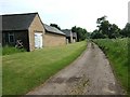
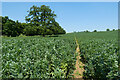
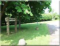
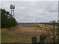
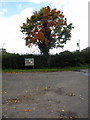
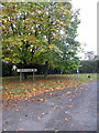
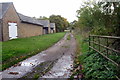
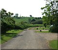
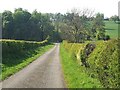
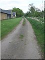
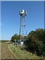
Battlesden is a small rural hamlet and civil parish located in the Central Bedfordshire district of Bedfordshire. This community covers an area of 4.6 km² and sits just north of the A5 road at the Watling Street. You will find the landscape divided by three south-west flowing streams, with the terrain averaging around 400 feet above sea level. The geology here consists of Gault Formation mudstone and till, reflecting the damp conditions that led to the poor soil quality for ancient ploughs. The name Battlesden comes from the Domesday Book of 1086, where it was recorded as Badelsdone, meaning "Badel's hill." Life in this parish operates quietly, functioning as a meeting place with a civil electorate of 28 people. The village is one of eight parishes in the district without a council, meaning local governance takes a different form than in larger towns. You will encounter the historic St. Peter's Church standing at approximately 445 feet, which serves as the parish church. The area is part of the Aspley and Woburn ward and adjoins parishes including Hockliffe, Potsgrove, and Milton Bryan. Residents rely on Woburn Road, a course established from the early 1830s, as the primary internal route. Farming has historically been difficult here. The soil quality was too poor for the heavy ploughs used in the medieval period. This limitation shaped the low population density that characterises Battlesden today. While the landscape is static and historic, the hamlet remains very low in population. The parish boundary was revised in 1984 along the A5, updating the limits around Hockliffe and the former Swan public house. The geology and the streams define the physical boundaries of living in Battlesden. You will find the Centre Farm ridge at 405 feet and Battlesden Lodge at 360 feet marking the higher ground. Major transport links are limited to the A5. The parish does not have a railway station or regular bus services. Property owners must rely on the road network for commuting.
- Area Type
- Parish
- Area Size
- 4.6 km²
- Population
- Not available
- Population Density
- Not available
Demographics
The community in Battlesden is characterised by a very distinct age profile. The median age for residents is 70 years old, indicating that the area is home to a predominantly older population. An analysis of the demographic data shows that the "Age: Total" range represents the standard reporting category for the parish. This high median age suggests that Battlesden is not a hub for young families or students, but rather a retirement destination or a preferred location for older retirees. Home ownership is a central feature of daily life in this hamlet. Official records show that 55% of households in Battlesden own their homes outright or with a mortgage. This level of ownership ensures that the majority of residents are long-term community members rather than short-term tenants looking for temporary accommodation. The total household composition and total accommodation type data confirm that the stock is stable and geared towards established residents who have chosen to live in this rural setting. There is no significant data available regarding the predominant ethnic group or religious affiliation for the parish. The available research indicates a community that has remained largely static since the Domesday Book. With an electorate of only 28 people, the community feels intimate and close-knit. You will find that the total population has remained low for centuries due to the agricultural challenges of the land. Living in Battlesden means being part of a tiny, tight-knit group where the age profile skews heavily towards senior citizens. Median Age: 70 Home Ownership Rate: 55%
Household Size
Accommodation Type
Tenure
Ethnic Group
Religion
Household Composition
Age
Household Deprivation
NS-SEC
Explore more demographic insights in this area
Go to Demographics tabPlanning
Planning Constraints
- Flood RiskPremium
- Ramsar Wetland SitesPremium
- Area of Outstanding Natural BeautyPremium
- Protected Nature ReservePremium
- Crime RiskPremium