Area Overview for Barsham
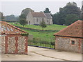
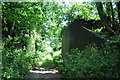
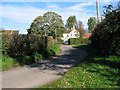
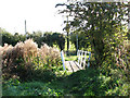
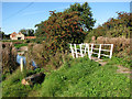
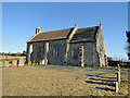
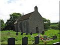
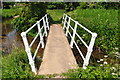
Photos of Barsham
Area Information
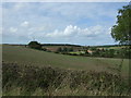
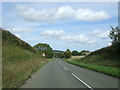
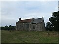
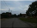
Living in Barsham offers a quiet existence within a civil parish covering 19.4 km². This rural settlement provides a stark contrast to the hustle of larger towns, defined by space over urban convenience. You will find yourself in an area that prioritises tranquility, making it a significant choice for those prioritising peace over public transport links. The boundaries of the parish encompass only a few isolated landmarks, creating a very specific and contained living environment. There is no sign of a traditional high street or developed town centre within these borders. Instead, life revolves around the immediate natural surroundings and private roads. The setting is strictly residential and agricultural, away from the main arteries connecting the east of England. It is a place where the pace of daily life is dictated by the seasons rather than commuter schedules. Buyers should understand that accepting a home here means accepting a self-contained lifestyle far from the bustle of Norwich or Thetford. The charm lies entirely in the isolation and the expansive skies above. If your definition of a neighbourhood relies on local cafes or bus stops, Barsham may not meet your needs. However, for those who value open space, this civil parish delivers exactly that.
- Area Type
- Parish
- Area Size
- 19.4 km²
- Population
- Not available
- Population Density
- Not available
Demographics
The community in Barsham is defined by a distinct age profile that differs from the national average. Evidence shows the median age is 70 years, indicating a population dominated by older residents. The most common age range simply falls under the total aggregate for the census, reinforcing the lack of young families in the picture. You are buying into an area where neighbours are likely to be retirees or those living in their long-term properties. Home ownership stands at 55%, a figure higher than many urban counterparts but suggesting that significant numbers still reside in rented or social accommodation. This split indicates a mixed community rather than a private estate. Household composition data is recorded only as a total, offering no breakdown for single-person or multi-generational homes. You cannot assume a family-friendly existence based on the available records. The demographic data reflects a settled, older population with established roots rather than transient workers. This stability means strong local ties but potentially limited local services tailored to children or young professionals. The area is not expanding rapidly; it is a static community. Prospective buyers must accept the reality of living among an older cohort where the energy of a typical suburban estate is absent.
Household Size
Accommodation Type
Tenure
Ethnic Group
Religion
Household Composition
Age
Household Deprivation
NS-SEC
Explore more demographic insights in this area
Go to Demographics tabPlanning
Planning Constraints
- Flood RiskPremium
- Ramsar Wetland SitesPremium
- Area of Outstanding Natural BeautyPremium
- Protected Nature ReservePremium
- Protected WoodlandPremium
- Crime RiskPremium