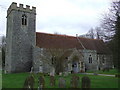
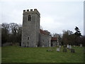
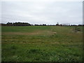
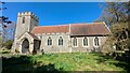
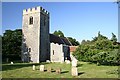
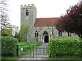
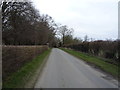
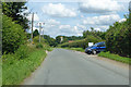
Area Overview for Barrow
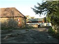
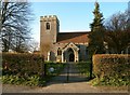
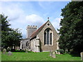
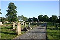
Photos of Barrow
Area Information
Barrow is a compact district borough unitary ward covering just 10.8 square kilometres. You will find this location very different from typical suburban expansions. The area stands out for its strong sense of community and established residential character. Most residents here own their homes, creating a stable local environment. Daily life revolves around convenience, with a high percentage of households living in properties they hold outright. This focus on home ownership suggests a neighbourhood built for long-term living rather than short-term rentals. Living in Barrow means navigating a space defined by quiet streets and mature planning constraints. The small footprint means amenities are likely within walking distance for many families. You should expect a pace of life that prioritises community interaction over rapid development. The area does not contain major protected nature reserves or Ramsar wetland sites, which simplifies certain planning considerations. However, you must be aware that some protected woodland exists within the bounds of this ward. This limits potential building schemes and preserves existing green corridors. Safety is a primary concern for any buyer, and Barrow scores highly in this regard. The neighbourhood recorded low crime rates recently, offering peace of mind for families settling down. Flood risk analysis confirms that large areas face minimal threat from water inundation. This combination of security and natural stability makes Barrow an attractive option for those seeking a settled, owner-occupied environment. The demographic profile supports this view, with a significant portion of the population aged seventy years and over. Understanding these core facts helps you decide if this specific ward matches your lifestyle requirements.
- Area Type
- District Borough Unitary Ward
- Area Size
- 10.8 km²
- Population
- Not available
- Population Density
- Not available
Demographics
The community in Barrow has a distinct age profile that sets it apart from growing young suburbs. Data indicates a median age of seventy years, meaning half the population is older than this threshold. This demographic skew reflects a retirement-friendly environment where many residents have chosen to stay put or move into older locally. Nearly three-quarters of British residents in this ward, specifically 72%, own their homes outright. This high ownership rate contrasts sharply with metropolitan rental markets and signals deep community roots. Most common age ranges and household composition data reflect this mature population. You will encounter fewer young families with multiple children compared to areas like Manchester or Leeds. Instead, the neighbourhood accommodates empty nesters and retirees. The specific breakdown of age groups shows a concentration of older adults, which shapes local services and social groups. While specific data on predominant ethnic groups and religious affiliations does not appear in current records, the overall picture remains one of long-term stability. Deprivation levels are not explicitly detailed in the available statistics, but the high home ownership rate often correlates with financial security among residents. You should consider what this means for local quality of life. A stable, older population often leads to quieter streets and established neighbourhood watch groups. The area does not rely on transient populations, which can sometimes drive up local tensions. This consistency benefits those who value predictability in their daily surroundings. When evaluating homes in Barrow, keep in mind that you are entering a market dominated by established residents.
Household Size
Accommodation Type
Tenure
Ethnic Group
Religion
Household Composition
Age
Household Deprivation
NS-SEC
Explore more demographic insights in this area
Go to Demographics tabPlanning
Planning Constraints
- Flood RiskPremium
- Ramsar Wetland SitesPremium
- Area of Outstanding Natural BeautyPremium
- Protected Nature ReservePremium
- Protected WoodlandPremium
- Crime RiskPremium