Area Overview for Barningham Ward
Photos of Barningham Ward
Area Information
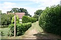
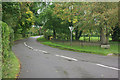
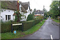
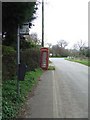
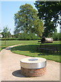
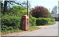
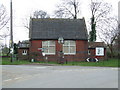
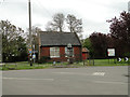
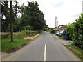
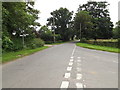
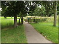
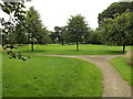
Living in Barningham Ward offers a distinct experience within the West Suffolk district of East of England. This electoral ward covers an area of 33.8 square kilometres and encompasses the village and civil parish of Barningham. The location sits approximately 12 miles north-east of Bury St Edmunds, providing a quiet backdrop for those who value rural life. The settlement dates back to the Domesday Book of 1086, where it was first recorded as a homestead of Beorn's people. The area has a deep local history, having been purchased by the wealthy puritan Maurice Barrow in 1628. Later in its history, the pharmaceutical company Fisons originated here as a flour mill and bakery in the late 18th century. Barningham today acts as the central hub for the ward, featuring essential local amenities such as the Royal George pub and a shop with a post office. You will find a church, a hairdresser's, and a village hall serving the community. The coordinates place the vicinity near 52.35°N 0.883°E, offering a precise geographical anchor for your understanding of the neighbourhood. This area blends historical significance with practical daily living in a controlled environment.
- Area Type
- District Borough Unitary Ward
- Area Size
- 33.8 km²
- Population
- Not available
- Population Density
- Not available
Demographics
The community profile of Barningham Ward reveals a settled population with a notably older demographic. The median age for residents is 70, indicating that the area is dominated by older adults. This age profile suggests a community where long-term stability is the norm rather than a transient workforce of young professionals. Home ownership stands at a high figure of 78%, which confirms that most households are owner-occupiers rather than tenants or investors. This level of ownership typically correlates with residents who have lived in the area for many years. While specific details on household composition, predominant ethnicity, and religion are not detailed in the current statistics, the ownership rate provides a clear picture of the social fabric. A high ownership percentage often means that local decisions regarding schools or transport reflect the needs of a permanent resident base. The absence of rental speculation in the main stock fosters a neighbourhood where neighbours know each other over decades. You should expect a quiet atmosphere where the pace of life adjusts to the rhythms of retirees and older families.
Household Size
Accommodation Type
Tenure
Ethnic Group
Religion
Household Composition
Age
Household Deprivation
NS-SEC
Explore more demographic insights in this area
Go to Demographics tabPlanning
Planning Constraints
- Flood RiskPremium
- Ramsar Wetland SitesPremium
- Area of Outstanding Natural BeautyPremium
- Protected Nature ReservePremium
- Protected WoodlandPremium
- Crime RiskPremium