Area Overview for Barnby and North Cove
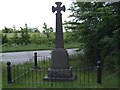
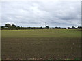
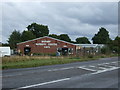
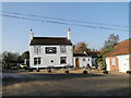
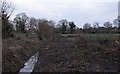
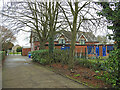
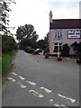
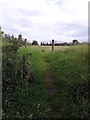
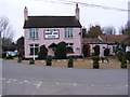
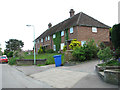
Photos of Barnby and North Cove
Area Information
Barnby and North Cove is a compact built-up area spanning 44.9 hectares in England, offering a quiet, established setting for residents. The area’s population skews older, with a median age of 70, suggesting a community of long-term residents. This is reflected in the high home ownership rate of 81%, indicating a stable, settled demographic. Daily life here is likely shaped by proximity to local amenities, including a primary school with a good Ofsted rating and nearby retail and transport links. The area’s modest size means it is easy to navigate, with key services within practical reach. While not a bustling urban centre, Barnby and North Cove provides a straightforward, low-maintenance lifestyle. Its appeal lies in its simplicity: a place where convenience and familiarity take precedence over novelty. For those seeking a peaceful, mature community with access to essential services, this area offers a clear, uncluttered alternative to more dynamic locations.
- Area Type
- Built Up Area 250
- Area Size
- 44.9 hectares
- Population
- Not available
- Population Density
- Not available
Residents of Barnby and North Cove have access to a range of nearby amenities, including Beccles Airport, which provides regional air travel options. Retail facilities within reach include East of England Co-operative Co, Morrisons Beccles, and Co-op Carlton, offering everyday shopping needs. Five rail stations, including Beccles Railway Station, ensure connectivity to surrounding areas. While the data does not mention parks or leisure facilities, the presence of multiple retail and transport hubs suggests a practical, service-oriented lifestyle. The area’s amenities cater to daily necessities, with a focus on accessibility rather than luxury. For those prioritising convenience and functional living, Barnby and North Cove provides a straightforward, no-frills environment.
Amenities
Schools
The primary education option near Barnby and North Cove is Barnby and North Cove Community Primary School, which serves the local area. This school has an Ofsted rating of ‘good’, indicating it meets national standards for teaching quality and student outcomes. As the only school listed in the data, it is the primary educational institution for children in the area. The absence of secondary schools or specialist provisions suggests families may need to travel further for secondary education. However, the ‘good’ rating for the primary school offers reassurance for parents prioritising early education. For families with young children, the school’s proximity and performance are significant factors in assessing the area’s suitability.
| Rank | School | Type | Entry gender | Ages |
|---|
Explore more schools in this area
Go to Schools tabDemographics
The population of Barnby and North Cove has a median age of 70, the highest age group recorded in the data, suggesting a community predominantly composed of older adults. Home ownership is exceptionally high at 81%, indicating that most residents own their properties rather than rent. This reflects a demographic likely prioritising stability over mobility. The data does not specify household composition or accommodation types, but the high home ownership rate implies a mix of family homes and single-occupancy properties. The area’s ethnic and religious diversity is not quantified, but the absence of specific figures suggests a relatively homogenous population. For residents, this translates to a close-knit community with shared values and long-term residency. The age profile also means local services are tailored to older adults, with healthcare and leisure facilities likely designed for this demographic.