Area Overview for Barham
Photos of Barham
Area Information
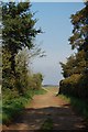
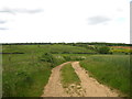
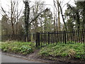
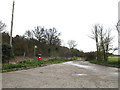
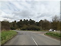
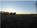
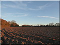
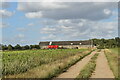
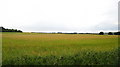
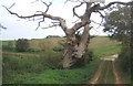
Living in Barham offers a quiet existence within a civil parish that covers just 7.3 square kilometres. This small footprint defines a compact community where distances are minimal and local knowledge goes a long way. You will find yourself in a setting that mirrors the broader rural landscape, characterised by a distinct lack of large-scale urban development. The areadoctype is simple, reflecting a lifestyle dominated by the immediate surroundings rather than distant city centres. Daily life here is shaped by scale. With a total area this restricted, access to amenities relies heavily on planned villages and established neighbourhoods within the parish boundaries. The environment is largely defined by open spaces rather than dense clusters of apartment blocks. You might expect a slower pace of life, supported by the inherent nature of a village location. This setting suits those who prioritise proximity to nature over the convenience of a high-density urban centre. The identity of Barham is rooted in its specific geographic boundaries. It functions as a self-contained community where the whole parish feels like a neighbourhood. Residents navigate a landscape that is both intimate and spacious, provided you account for the limited square mileage. The area feels manageable, allowing for easy exploration on foot or by car without becoming overwhelmed by extensive infrastructure. This locality offers a settled atmosphere that contrasts sharply with the constant movement of larger towns or cities.
- Area Type
- Parish
- Area Size
- 7.3 km²
- Population
- Not available
- Population Density
- Not available
Demographics
The community in Barham is statistically defined by an older population, with a median age of 70 years. This figure indicates that the majority of residents belong to the age group associated with retirement. When you look at the household composition and accommodation types, the data reflects a population that has settled into long-term living arrangements. The demographic profile suggests a village that serves as a retirement destination rather than a hub for young families or students. Home ownership stands at 84 per cent within this parish. This high level indicates that most people have purchased their homes to stay for the long term. You rarely encounter transient rental markets here because the ownership rate locks in stability for the majority of households. The lack of data on specific ethnic groups or religious demographics is irrelevant to the physical reality of the area, which is dominated by this age group. The household composition reinforces a static society where people know their neighbours through decades of shared residency. This demographic structure means the area functions very differently from a young, developing town. You are living alongside a community that values permanence over rapid change. The high ownership rate supports local businesses that cater to an older clientele, rather than those targeting young professionals. The population density aligns with the area's restrictive footprint, creating a tight-knit social structure. Ultimately, living in Barham means joining a community where the demographic reality is one of maturity and established residency.
Household Size
Accommodation Type
Tenure
Ethnic Group
Religion
Household Composition
Age
Household Deprivation
NS-SEC
Explore more demographic insights in this area
Go to Demographics tabPlanning
Planning Constraints
- Flood RiskPremium
- Ramsar Wetland SitesPremium
- Area of Outstanding Natural BeautyPremium
- Protected Nature ReservePremium
- Protected WoodlandPremium
- Crime RiskPremium