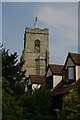
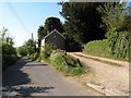
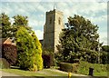
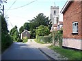
Area Overview for Bardwell
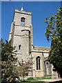
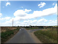
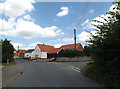
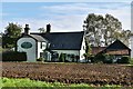
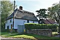
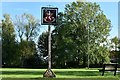
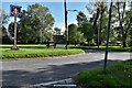
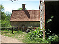
Photos of Bardwell
Area Information
Living in Bardwell offers a quiet, compact environment in a built-up area spanning 42.7 hectares in England. With a median age of 70, the community is predominantly older, reflecting a demographic that values stability and familiarity. The area is largely owner-occupied, with 81% of homes owned by residents, suggesting a long-term presence of households. Bardwell’s proximity to two Church of England primary schools and nearby amenities like RAF Honington and two railway stations—Entrance and Thurston—provides practical connectivity for daily life. The low crime risk, with a safety score of 96, further reinforces its appeal as a secure place to live. While the area is small, its accessibility to transport networks and essential services makes it a viable choice for those seeking a balanced lifestyle. The presence of local shops, including Co-op Stanton and Spar, ensures everyday needs are met without long commutes. Bardwell’s character is defined by its mix of residential tranquillity and functional infrastructure, making it suitable for retirees or those prioritising safety and convenience.
- Area Type
- Built Up Area 250
- Area Size
- 42.7 hectares
- Population
- Not available
- Population Density
- Not available
Bardwell’s lifestyle is shaped by its proximity to essential amenities and local services. The area includes five retail outlets, such as Co-op Stanton and Spar, providing everyday shopping convenience. Nearby RAF Honington adds a unique dimension to the community, potentially offering employment or recreational opportunities. The two railway stations—Entrance and Thurston—ensure residents can easily travel to surrounding areas for work, leisure, or socialising. While the data does not mention parks or leisure facilities, the presence of local shops and transport links suggests a practical, community-focused lifestyle. The compact nature of Bardwell means residents can access most services without long commutes. For those valuing convenience over expansive green spaces, the area’s amenities offer a functional, if modest, quality of life. The mix of retail, transport, and military infrastructure creates a distinct character, ideal for those seeking simplicity and accessibility.
Amenities
Schools
Bardwell is served by two primary schools: Bardwell Church of England Voluntary Controlled Primary School and Bardwell Church of England Primary School, the latter of which holds a “good” Ofsted rating. Both institutions are Church of England-affiliated, offering a faith-based education for younger children. The presence of two primary schools within the area ensures families have options for their children’s early education. The “good” rating at one school suggests a higher standard of teaching and facilities, which may be a key consideration for parents. However, no secondary schools are listed in the data, so families may need to look beyond Bardwell for secondary education. The mix of schools reflects a focus on primary education, aligning with the area’s older demographic. For families prioritising early schooling, Bardwell’s schools provide a solid foundation, though further research would be needed for secondary options.
| Rank | School | Type | Entry gender | Ages |
|---|
Explore more schools in this area
Go to Schools tabDemographics
Bardwell’s population has a median age of 70, indicating a community skewed towards older adults. The most common age range is listed as “Total,” suggesting aggregated data rather than specific age brackets. Home ownership is high, with 81% of properties owned by residents, reflecting a stable, long-term demographic. The data does not specify household composition or accommodation types, but the overall figures imply a predominantly older population with established living arrangements. No details are provided on ethnic diversity or religious composition, meaning these aspects cannot be discussed. The high home ownership rate suggests a community focused on permanence, with fewer transient residents. For quality of life, the absence of specific deprivation data means broader socioeconomic factors remain unexplored. However, the safety profile and access to essential services suggest a functional, if aging, population.
Household Size
Accommodation Type
Tenure
Ethnic Group
Religion
Household Composition
Age
Household Deprivation
NS-SEC
Explore more demographic insights in this area
Go to Demographics tabPlanning
Planning Constraints
- Crime RiskPremium