Area Overview for Baldock East Ward
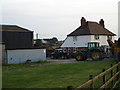
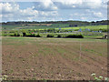
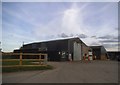
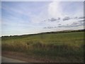
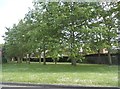
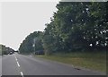
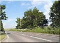
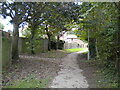
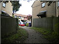
Photos of Baldock East Ward
Area Information
Living in Baldock East Ward offers a distinct experience within the town of Baldock, though it represents one of the smaller residential units in the region. This electoral ward covers just 2.7 square kilometres and is home to 1,039 residents. You will find yourself situated in the North East Hertfordshire parliamentary constituency, under the oversight of North Hertfordshire District Council. The density stands at 380 people per square kilometre, which suggests a settled, non-dense environment rather than a bustling urban hub. Daily life here is shaped by the ward's specific location and its integration into the wider Baldock area. The ward exists as a defined administrative boundary with coordinates centred around 51.99 degrees north and -0.17 degrees west. Prospective buyers should approach this area with an understanding of its compact size and population scope. It is not a vast estate but a focused district where local governance and community needs are managed on a granular level. The area serves as a microcosm of the larger town of Baldock, providing a residential zone that operates within the established administrative framework of North Hertfordshire. You are purchasing into a space with clear governance structures and a defined footprint. The uniqueness of Baldock East Ward lies in this precise administrative definition and its role within the broader North East Hertfordshire landscape. It is a place where residents know their boundaries and where the community, with just over a thousand souls, operates within a tight-knit geographical square projected onto the map.
- Area Type
- District Borough Unitary Ward
- Area Size
- 2.7 km²
- Population
- 1039
- Population Density
- 380 people/km²
Demographics
The community profile within Baldock East Ward is heavily weighted towards an older demographic, making it a significantly age-skewed neighbourhood. The median age for residents is 70, a figure that starkly contrasts with the national average and signals a specific lifestyle choice or retention pattern. This age constraint defines the social fabric, meaning you are joining an area where the population is substantially older than the rest of the country. The data confirms the most common age range falls for the "Total" population category, reinforcing that this is not a family-centric zone but a settlement established by those in their later years. Home ownership is the predominant mode of dwelling here, with 81% of the ward owned outright or partly owned. This high rate indicates a long-term settlement history rather than a transient rental market. Households, accommodation types, predominant ethnic groups, and religious affiliations are recorded as totals in the available records, yet the ownership statistic remains the clearest demographic marker. This lack of rental housing suggests stability and deep roots in the community. The absence of a significant younger population and the dominance of elderly homeowners paint a clear picture of who lives here. You are looking at an area where the residents likely prioritised purchase over rent long ago, resulting in a community where the property owner is also the primary resident. The social dynamic reflects this stability, with 81% ownership creating a static, low-turnover environment for those considering a move into Baldock East Ward.
Household Size
Accommodation Type
Tenure
Ethnic Group
Religion
Household Composition
Age
Household Deprivation
NS-SEC
Explore more demographic insights in this area
Go to Demographics tabPlanning
Planning Constraints
- Flood RiskPremium
- Ramsar Wetland SitesPremium
- Area of Outstanding Natural BeautyPremium
- Protected Nature ReservePremium
- Protected WoodlandPremium
- Crime RiskPremium