Area Overview for Baker Street
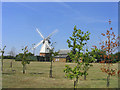
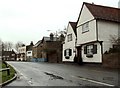
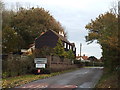
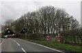
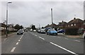
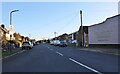
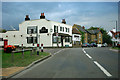
Photos of Baker Street


Area Information
Baker Street in England is a compact built-up area spanning 26.9 hectares, offering a blend of residential and practical amenities. With a median age of 70, it is home to a community that values stability and proximity to essential services. The area’s character is shaped by its accessibility to retail, transport, and water-based connectivity. Nearby, five retail outlets including Tesco Grays and Morrisons Daily Chadwell St cater to daily needs, while five rail stations such as Grays Railway Station provide links to broader networks. Three ferry terminals, including Tilbury Ferry Terminal, add to the area’s connectivity. The low crime risk score of 74 suggests a safer environment, though the demographic data highlights a predominantly older population. Living here means prioritising convenience over novelty, with a focus on established infrastructure and reliable access to services. The 76% home ownership rate indicates a settled community, where properties are likely to be long-term holdings rather than transient rentals. For buyers, Baker Street offers a straightforward choice: a functional, low-maintenance area with clear practical advantages.
- Area Type
- Built Up Area 250
- Area Size
- 26.9 hectares
- Population
- Not available
- Population Density
- Not available
Living in Baker Street offers a practical lifestyle with access to essential amenities within walking or short driving distance. Retail options include five shops such as Tesco Grays, Co-op Socketts, and Morrisons Daily Chadwell St, ensuring daily needs are met without the need to travel far. The area’s rail network, with five stations including Grays Railway Station and East Tilbury Railway Station, provides convenient access to nearby towns and cities. For those who prefer water-based travel, three ferry terminals—Tilbury Ferry Terminal, West Street Pier, and Town Pier—offer additional connectivity. While the area lacks detailed information on parks or leisure facilities, the presence of multiple retail and transport hubs suggests a focus on functionality over leisure. This makes Baker Street ideal for those prioritising convenience and reliability in their daily routines.
Amenities
Schools
| Rank | School | Type | Entry gender | Ages |
|---|
Explore more schools in this area
Go to Schools tabDemographics
Baker Street’s population has a median age of 70, with the most common age range encompassing all age groups. This suggests a community skewed towards older residents, though the data does not specify proportions of younger demographics. Home ownership is high at 76%, indicating a strong presence of long-term residents rather than renters. The accommodation types and household compositions are not detailed, but the data notes that these categories are represented in full. The predominant ethnic group and religious affiliation are not specified, as both are listed as “total,” meaning no single group dominates. This lack of specificity implies a diverse but unquantified mix. The absence of deprivation data means no conclusions can be drawn about economic challenges, but the high home ownership rate and practical amenities suggest a stable, if not affluent, environment. For buyers, the area’s demographic profile aligns with those seeking a settled, low-risk location with minimal turnover.
Household Size
Accommodation Type
Tenure
Ethnic Group
Religion
Household Composition
Age
Household Deprivation
NS-SEC
Explore more demographic insights in this area
Go to Demographics tabPlanning
Planning Constraints
- Crime RiskPremium