Area Overview for Bagthorpe with Barmer
Photos of Bagthorpe with Barmer
Area Information
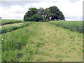
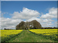
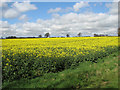
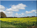
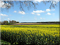
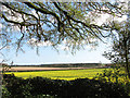
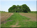
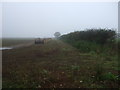
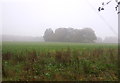
Bagthorpe with Barmer is a civil parish covering 9.0 km² in England, offering a defined rural setting for residents seeking a contained lifestyle. The area provides a specific environment where daily life unfolds without the constraints of major urban centres or significant planning restrictions. You will find living in this parish means accepting a location that prioritises space over density, with no protected woodlands, nature reserves, or Areas of Outstanding Natural Beauty limiting development potential. This status indicates a relatively straightforward planning environment compared to more constrained countryside locations. The community functions as a self-contained unit where the lack of Ramsar wetland sites or flood risk coverage ensures that environmental safety does not dictate home ownership rules. Safety scores reflect a secure neighbourhood, allowing you to focus on the estate rather than worrying about external hazards. When considering homes in Bagthorpe with Barmer, you are looking at a property where the primary considerations are the physical size of the land and the age of the existing structures. The area represents a straightforward choice for those who want a clear picture of their surroundings without navigating complex environmental designations or worrying about high-risk safety categories affecting their investment security.
- Area Type
- Parish
- Area Size
- 9.0 km²
- Population
- Not available
- Population Density
- Not available
Demographics
The community profile of Bagthorpe with Barmer reveals an area where 65% of households are owner-occupied, indicating a deeply settled population with strong local ties. This high rate of home ownership suggests that the residents are likely long-term anchors rather than transient movers, creating a stable atmosphere for anyone choosing to live in the parish. The social fabric here is defined by an older demographic, with a median age of 70 years. This figure highlights that the most common age range aligns closely with retirees and older adults who have owned their properties for decades. When you examine the household composition, the data confirms that families with young children or working-age earners are less prevalent than in urban counterparts. Consequently, the daily rhythm of the village will be shaped by individuals who value quiet and consistency over fast-paced social trends. If you are considering buying a home near Bagthorpe with Barmer, you are joining a community where neighbours are likely to be of similar age, sharing a history of staying put. This demographic reality means that local services and social groups cater primarily to mature residents, which influences the general pace of life in this civil parish.
Household Size
Accommodation Type
Tenure
Ethnic Group
Religion
Household Composition
Age
Household Deprivation
NS-SEC
Explore more demographic insights in this area
Go to Demographics tabPlanning
Planning Constraints
- Flood RiskPremium
- Ramsar Wetland SitesPremium
- Area of Outstanding Natural BeautyPremium
- Protected Nature ReservePremium
- Protected WoodlandPremium
- Crime RiskPremium