Area Overview for Badwell Ash
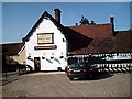
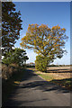
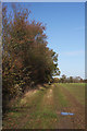
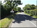
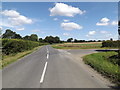
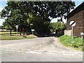
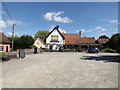
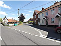
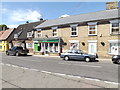
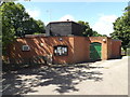
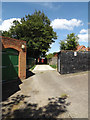
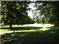
Photos of Badwell Ash
Area Information
Living in Badwell Ash offers a quiet, compact environment within a 39.1-hectare built-up area. The community is characterised by its older demographic, with a median age of 70, suggesting a population that may be more established or retired. This age profile shapes the local rhythm, with fewer young families but a stable, long-term presence. The area’s proximity to Elmswell Railway Station and nearby retail outlets like Budgens Badwell and Co-op Stanton ensures practical access to daily essentials. While Badwell Ash is small, its infrastructure supports basic needs, and the presence of Badwell Ash Church of England Voluntary Aided Primary School adds to its appeal for families. The low crime risk score of 92 indicates a safe environment, though the area’s character is defined by its simplicity and limited expansion. For those seeking a low-maintenance, community-focused lifestyle, Badwell Ash provides a straightforward, functional living experience without the complexity of larger urban areas.
- Area Type
- Built Up Area 250
- Area Size
- 39.1 hectares
- Population
- Not available
- Population Density
- Not available
Residents of Badwell Ash have access to five retail outlets, including Budgens Badwell, Budgens Norton, and Co-op Stanton, ensuring proximity to essential shopping and services. These stores likely cater to daily needs, from groceries to household items, reducing the need for long journeys. The area’s rail network, with four stations including Elmswell Railway Station, provides connectivity to surrounding regions, supporting both leisure and commuting. While specific parks or leisure facilities are not mentioned in the data, the compact size of the area suggests limited green spaces. The presence of a primary school and retail amenities contributes to a self-contained lifestyle, where most necessities are within practical reach. The character of Badwell Ash appears to be one of convenience and simplicity, with a focus on accessibility rather than expansive recreational opportunities.
Amenities
Schools
The only school explicitly listed near Badwell Ash is the Badwell Ash Church of England Voluntary Aided Primary School. This institution serves the local primary education needs, though no Ofsted rating or performance data is provided. The absence of secondary schools or additional educational institutions means families may need to look beyond the immediate area for comprehensive schooling. The single primary school suggests a limited range of educational options, which could be a consideration for parents prioritising a variety of school types or higher academic standards. However, the presence of a primary school within the area offers convenience for younger children and may contribute to a sense of community cohesion. For those requiring secondary education, commuting to nearby towns or villages would be necessary, which could impact daily routines and travel time.
| Rank | A + A* % | School | Type | Entry gender | Ages |
|---|---|---|---|---|---|
| 1 | N/A | Badwell Ash Church of England Voluntary Aided Primary School | primary | N/A | N/A |
Explore more schools in this area
Go to Schools tabDemographics
The population of Badwell Ash has a median age of 70, reflecting a community skewed towards older residents. This age profile influences household composition, though specific data on family structures or lone occupants is not available. Home ownership stands at 73%, indicating a majority of residents live in properties they own rather than rent. The accommodation types and predominant ethnic groups are listed as "total," meaning no breakdowns are provided for these categories. This suggests the area’s diversity or housing stock variety is not detailed in the data. The lack of specific figures on deprivation or income levels means it is unclear how economic factors might affect quality of life. However, the high home ownership rate and low crime risk imply a stable, low-risk environment for residents. The demographic profile underscores a mature, settled population, which may appeal to those prioritising safety and simplicity over dynamic, evolving communities.
Household Size
Accommodation Type
Tenure
Ethnic Group
Religion
Household Composition
Age
Household Deprivation
NS-SEC
Explore more demographic insights in this area
Go to Demographics tabPlanning
Planning Constraints
- Crime RiskLocked