Area Overview for Baconsthorpe
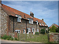
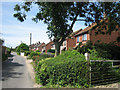
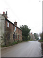
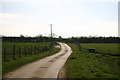
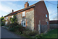
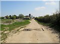
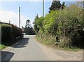
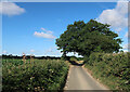
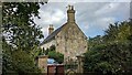
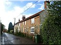
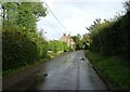
Photos of Baconsthorpe
Area Information
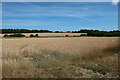
Baconsthorpe is a distinct parish covering an area of 5.5 square kilometres in England. It stands out as a settled community where residents enjoy a significant degree of local autonomy. The parish offers a defined residential space that balances proximity to larger towns with a degree of privacy that many homebuyers seek. You will find that daily life here revolves around a quiet, established neighbourhood rather than the noise of a major urban centre. The compact size means distances are short, allowing you to walk to local amenities if they exist within the parish bounds. This setting appeals to those who prefer a slower pace but still require reliable access to essential services. Living in Baconsthorpe involves adapting to a specific type of English village existence. The landscape and historic boundaries create a sense of permanence that defines the local identity. You are part of a community with deep roots, evidenced by the high rate of long-term residency. The area does not boast bustling high streets or massive commercial hubs, which keeps property prices more manageable compared to city edges. However, you must consider exactly what facilities lie within the 5.5 km² boundary versus what requires a short trip elsewhere. This parish is ideal for you if you value space and tranquility without sacrificing total isolation. The civil parish status ensures local governance exists to maintain standards and infrastructure for your home. The people of Baconsthorpe form a settled community with a clear median age of 70 years. This figure indicates that the population is heavily skewed towards older residents, likely reflecting the area's appeal to retirees or those seeking a quieter retirement in a rural setting. A homebuyer should expect neighbours who have lived in Baconsthorpe for decades, creating stable social networks that benefit families with elderly relatives or individuals without children. The demographic profile suggests that the area has seen little recent influx of young professionals, which might affect the vibrancy of local amenities during weekday evenings. You will encounter a household ownership rate of 70 per cent within the parish. This high figure demonstrates that most homes in Baconsthorpe are owner-occupied rather than rented properties. Such stability often correlates with lower turnover rates and a slower moving local market compared to rental-heavy zones. The accommodation types and household compositions reflect this mature profile, likely featuring larger dwellings suitable for families in their later years or downsizers. Ethnically and religiously, the community presents a uniform picture typical of many historic English villages, where tradition often shapes social structures. If you are looking to settle permanently, the environment offers a predictable lifestyle with established routines. The age distribution means you should factor in proximity to healthcare services when evaluating your specific household needs. The property market in Baconsthorpe is defined by a majority owner-occupied culture, with 70 per cent of dwellings held by their residents. This dominance suggests a housing stock built over several decades, likely featuring semi-detached houses or bungalows common in older English parishes. You will find fewer modern developments or high-density rental blocks compared to urban fringe areas. The high ownership rate typically results in a market where houses remain with families until they move on for retirement elsewhere, keeping the community consistent over time. When viewing homes in Baconsthorpe, expect traditional construction and layouts designed for long-term living rather than transient tenancy. For buyers searching for detached or semi-detached family homes, this parish offers a straightforward marketplace. The lack of significant social housing or private rental pressure means prices often reflect the intrinsic value of the property and its location rather than speculative investment trends. However, the concentration of older owners might mean fewer properties hit the market at any one time, requiring patience if you wish to find a specific type of home. The 5.5 km² size limits development capacity, preserving the character of the neighbourhoods within Baconsthorpe. You should consider that the housing stock is not constantly refreshed with new builds, so thorough inspection is vital. The market dynamics here favour those who intend to stay long term, avoiding the transactional nature of high-turnover rental areas. Digital connectivity in Baconsthorpe presents a mixed picture for modern residents. You will experience good mobile network coverage with a score of 77 out of 100. This level of signal strength supports standard mobile usage, allowing you to stay connected via calls and messages while walking around the parish or visiting local attractions. However, fixed broadband quality presents a different reality with a score of only 33 out of 100. This relatively low rating indicates potential challenges for heavy internet users, remote workers, or families relying on video conferencing. You may encounter slower download speeds or latency issues during peak times compared to newer developments with fibre-ready infrastructure. If your lifestyle depends heavily on high-speed internet for work or entertainment, you must investigate specific connection speeds available at individual properties in Baconsthorpe. The variation in fixed line technology across a rural parish of this size can be significant. Some households might access decent speeds, while others struggle with older copper lines. For you, this means planning for potential extra costs to upgrade your connection or accepting certain limitations on streaming and large file transfers. Commuting by car remains the primary transport method given the rural setting, but waiting at home for a slow upload could impact your daily routine. Consider installing a backup solution if reliable broadband is critical for your profession. Safety in Baconsthorpe scores highly on both crime and environmental risk assessments, offering a stable environment for homebuyers. The area enjoys a crime risk safety score of 85 out of 100, indicating higher crime rates. This low crime figure confirms that Baconsthorpe is one of the safer neighbourhoods in the region, making it suitable for families and the elderly. You can expect minimal disruption from anti-social behaviour or theft, allowing for a peaceful evening routine without significant security concerns. This statistic reflects a community where residents look out for one another, minimising offences in what is effectively a low-crime zone. Environmentally, the parish presents no significant planning constraints that would limit potential changes or renovations. There is no flood risk, with a coverage score of 0.25 out of 100 confirming low flood risk in the area. You do not need to worry about future flooding from rivers or sea surges damaging your property. Furthermore, the land is free from planning restrictions such as Ramsar wetland sites, Areas of Outstanding Natural Beauty coverage, or protected nature reserves. These null scores confirm no restrictions on development or building work. You also benefit from the absence of protected woodland coverage that might otherwise limit tree removal or garden expansion. The lack of these environmental overlays means you have greater freedom regarding property improvements. What is the community profile like in Baconsthorpe?The community in Baconsthorpe is predominantly older, with a median age of 70 years. This reflects a settled population where 70 per cent of homes are owner-occupied. The area appeals to those seeking stability and a quieter life away from the fast pace of urban centres, supported by a low crime risk score of 85 out of 100. Is the internet reliable enough for working from home in Baconsthorpe?Mobile coverage is good with a score of 77 out of 100, but fixed broadband is limited with a score of 33 out of 100. Residents relying on high-speed internet for remote work may encounter slow speeds or latency. Future buyers should check specific connection speeds at their chosen property, as a significant upgrade might be required. Are there any environmental restrictions on building in Baconsthorpe?There are no significant environmental constraints in Baconsthorpe. The area has a flood risk score of 0.25, indicating very low risk. Additionally, scores for Ramsar sites, AONB, protected nature reserves, and protected woodland are all zero, meaning no planning restrictions apply to these environmental factors.
- Area Type
- Parish
- Area Size
- 5.5 km²
- Population
- Not available
- Population Density
- Not available
Demographics
The people of Baconsthorpe form a settled community with a clear median age of 70 years. This figure indicates that the population is heavily skewed towards older residents, likely reflecting the area's appeal to retirees or those seeking a quieter retirement in a rural setting. A homebuyer should expect neighbours who have lived in Baconsthorpe for decades, creating stable social networks that benefit families with elderly relatives or individuals without children. The demographic profile suggests that the area has seen little recent influx of young professionals, which might affect the vibrancy of local amenities during weekday evenings. You will encounter a household ownership rate of 70 per cent within the parish. This high figure demonstrates that most homes in Baconsthorpe are owner-occupied rather than rented properties. Such stability often correlates with lower turnover rates and a slower moving local market compared to rental-heavy zones. The accommodation types and household compositions reflect this mature profile, likely featuring larger dwellings suitable for families in their later years or downsizers. Ethnically and religiously, the community presents a uniform picture typical of many historic English villages, where tradition often shapes social structures. If you are looking to settle permanently, the environment offers a predictable lifestyle with established routines. The age distribution means you should factor in proximity to healthcare services when evaluating your specific household needs. The property market in Baconsthorpe is defined by a majority owner-occupied culture, with 70 per cent of dwellings held by their residents. This dominance suggests a housing stock built over several decades, likely featuring semi-detached houses or bungalows common in older English parishes. You will find fewer modern developments or high-density rental blocks compared to urban fringe areas. The high ownership rate typically results in a market where houses remain with families until they move on for retirement elsewhere, keeping the community consistent over time. When viewing homes in Baconsthorpe, expect traditional construction and layouts designed for long-term living rather than transient tenancy. For buyers searching for detached or semi-detached family homes, this parish offers a straightforward marketplace. The lack of significant social housing or private rental pressure means prices often reflect the intrinsic value of the property and its location rather than speculative investment trends. However, the concentration of older owners might mean fewer properties hit the market at any one time, requiring patience if you wish to find a specific type of home. The 5.5 km² size limits development capacity, preserving the character of the neighbourhoods within Baconsthorpe. You should consider that the housing stock is not constantly refreshed with new builds, so thorough inspection is vital. The market dynamics here favour those who intend to stay long term, avoiding the transactional nature of high-turnover rental areas. Digital connectivity in Baconsthorpe presents a mixed picture for modern residents. You will experience good mobile network coverage with a score of 77 out of 100. This level of signal strength supports standard mobile usage, allowing you to stay connected via calls and messages while walking around the parish or visiting local attractions. However, fixed broadband quality presents a different reality with a score of only 33 out of 100. This relatively low rating indicates potential challenges for heavy internet users, remote workers, or families relying on video conferencing. You may encounter slower download speeds or latency issues during peak times compared to newer developments with fibre-ready infrastructure. If your lifestyle depends heavily on high-speed internet for work or entertainment, you must investigate specific connection speeds available at individual properties in Baconsthorpe. The variation in fixed line technology across a rural parish of this size can be significant. Some households might access decent speeds, while others struggle with older copper lines. For you, this means planning for potential extra costs to upgrade your connection or accepting certain limitations on streaming and large file transfers. Commuting by car remains the primary transport method given the rural setting, but waiting at home for a slow upload could impact your daily routine. Consider installing a backup solution if reliable broadband is critical for your profession. Safety in Baconsthorpe scores highly on both crime and environmental risk assessments, offering a stable environment for homebuyers. The area enjoys a crime risk safety score of 85 out of 100, indicating higher crime rates. This low crime figure confirms that Baconsthorpe is one of the safer neighbourhoods in the region, making it suitable for families and the elderly. You can expect minimal disruption from anti-social behaviour or theft, allowing for a peaceful evening routine without significant security concerns. This statistic reflects a community where residents look out for one another, minimising offences in what is effectively a low-crime zone. Environmentally, the parish presents no significant planning constraints that would limit potential changes or renovations. There is no flood risk, with a coverage score of 0.25 out of 100 confirming low flood risk in the area. You do not need to worry about future flooding from rivers or sea surges damaging your property. Furthermore, the land is free from planning restrictions such as Ramsar wetland sites, Areas of Outstanding Natural Beauty coverage, or protected nature reserves. These null scores confirm no restrictions on development or building work. You also benefit from the absence of protected woodland coverage that might otherwise limit tree removal or garden expansion. The lack of these environmental overlays means you have greater freedom regarding property improvements. What is the community profile like in Baconsthorpe?The community in Baconsthorpe is predominantly older, with a median age of 70 years. This reflects a settled population where 70 per cent of homes are owner-occupied. The area appeals to those seeking stability and a quieter life away from the fast pace of urban centres, supported by a low crime risk score of 85 out of 100. Is the internet reliable enough for working from home in Baconsthorpe?Mobile coverage is good with a score of 77 out of 100, but fixed broadband is limited with a score of 33 out of 100. Residents relying on high-speed internet for remote work may encounter slow speeds or latency. Future buyers should check specific connection speeds at their chosen property, as a significant upgrade might be required. Are there any environmental restrictions on building in Baconsthorpe?There are no significant environmental constraints in Baconsthorpe. The area has a flood risk score of 0.25, indicating very low risk. Additionally, scores for Ramsar sites, AONB, protected nature reserves, and protected woodland are all zero, meaning no planning restrictions apply to these environmental factors.
Household Size
Accommodation Type
Tenure
Ethnic Group
Religion
Household Composition
Age
Household Deprivation
NS-SEC
Explore more demographic insights in this area
Go to Demographics tabPlanning
Planning Constraints
- Flood RiskPremium
- Ramsar Wetland SitesPremium
- Area of Outstanding Natural BeautyPremium
- Protected Nature ReservePremium
- Protected WoodlandPremium
- Crime RiskPremium