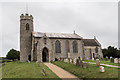
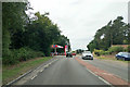
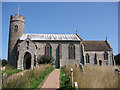
Area Overview for Aylmerton
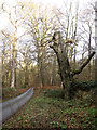
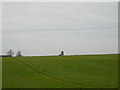
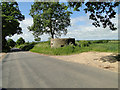
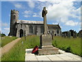
Photos of Aylmerton


Area Information
Living in Aylmerton offers a compact, well-defined environment within 28.3 hectares, blending residential spaces with accessible amenities. The area’s demographic profile is notable for its median age of 70, suggesting a community with a strong presence of older residents. This is reflected in the high home ownership rate of 80%, indicating a stable, long-term population. Daily life here is shaped by proximity to key services, with five rail stations within reach, including West Runton and Cromer, and retail hubs like Lidl and Morrisons in nearby Cromer. The area’s character is defined by its practical layout, where residents can access essential services without long commutes. While Aylmerton is small, its connectivity to surrounding towns via rail and metro links at Weybourne and Holt ensures it is not isolated. The broadband score of 74 ensures reliable digital access, supporting both work and leisure. For those seeking a quieter, established community with straightforward living, Aylmerton provides a straightforward, no-frills environment.
- Area Type
- Built Up Area 250
- Area Size
- 28.3 hectares
- Population
- Not available
- Population Density
- Not available
Aylmerton’s lifestyle is defined by its proximity to essential amenities, with retail options such as Lidl, Co-op, and Morrisons in Cromer just a short distance away. The presence of five rail stations, including Roughton Road and Cromer, ensures easy access to shopping, dining, and leisure opportunities in nearby towns. While the area itself may not have a dense network of parks or cultural venues, its connectivity to Weybourne and Holt via metro links opens up access to broader recreational options. The practical reach of these amenities means daily life is efficient, with residents able to meet most needs without long journeys. The character of Aylmerton is one of simplicity, where convenience is prioritised over novelty, making it suitable for those who value accessibility over urban vibrancy.
Amenities
Schools
| Rank | School | Type | Entry gender | Ages |
|---|
Explore more schools in this area
Go to Schools tabDemographics
Aylmerton’s population is predominantly older, with a median age of 70, reflecting a community where retirement is a common life stage. The home ownership rate of 80% underscores a demographic of long-term residents, many of whom may have lived in the area for decades. While the data does not specify household composition or accommodation types, the high home ownership figure suggests a stable, settled population. The area’s age profile means services and amenities are likely tailored to older adults, though the presence of multiple retail and transport options indicates efforts to maintain accessibility. The lack of specific data on diversity or religious composition means broader societal trends cannot be assessed, but the area’s demographics are clearly defined by age and tenure. This profile may appeal to those seeking a low-maintenance lifestyle with minimal disruption.
Household Size
Accommodation Type
Tenure
Ethnic Group
Religion
Household Composition
Age
Household Deprivation
NS-SEC
Explore more demographic insights in this area
Go to Demographics tabPlanning
Planning Constraints
- Crime RiskPremium