Area Overview for Attleborough Burgh & Haverscroft Ward
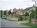
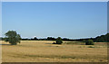
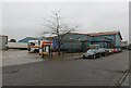
Photos of Attleborough Burgh & Haverscroft Ward
Area Information
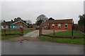
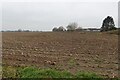
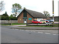
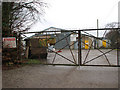
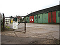
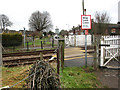
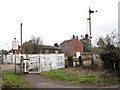
Attleborough Burgh & Haverscroft Ward occupies a central position within Norfolk, covering 7.3 km² of land between the coordinates of 52.51 and 1.01. This electoral ward forms part of the Breckland District Council and primarily serves the NR17 2** postcodes. Local landmarks include the High Street at NR17 2BT and Attleborough Library, which sits on Connaught Road. Residents benefit from proximity to these established community hubs while maintaining a distinct local identity. The area functions as a practical residential zone anchored by specific administrative boundaries. You can access the ward through the main High Street or via side roads connecting to surrounding neighbourhoods. The geography supports everyday living without the congestion often found in larger towns. Commuters and families alike navigate this compact district easily. The ward represents a stable environment for those seeking a straightforward approach to living in Attleborough. Proximity to the library and town centre ensures that daily errands remain quick and convenient. This location avoids unnecessary travel time while providing access to local services. Homebuyers appreciate the clear definition of boundaries that simplifies local governance and planning matters. The NR17 postcode range acts as the primary identifier for this specific slice of Norfolk.
- Area Type
- District Borough Unitary Ward
- Area Size
- 7.3 km²
- Population
- Not available
- Population Density
- Not available
Demographics
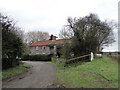
The community within Attleborough Burgh & Haverscroft Ward displays a distinct age profile centred on an older population. The median age reaches 70 years, indicating a settlement where retirees and older adults form the backbone of society. House ownership stands at 64%, a figure that significantly exceeds national averages for this age group. This high rate of ownership reflects the demographic trend of long-term residents who have settled in their current homes. The ward does not provide specific breakdowns for other ethnic groups or religious affiliations, so the community feel is defined primarily by age and tenure rather than cultural diversity metrics. Most households consist of individuals or couples, though exact percentage splits for single-person versus family units are not included in the available records. You should expect a quieter atmosphere where neighbours know each other through generations of residency. The lack of data on specific household composition types suggests uniformity in living arrangements rather than a mix of generational families. This demographic structure creates a stable environment where changes in occupancy happen gradually. Older residents often hold the deepest local knowledge about high streets and library facilities. The 64% ownership rate confirms that physical properties usually change hands only after long periods of stability.
Household Size
Accommodation Type
Tenure
Ethnic Group
Religion
Household Composition
Age
Household Deprivation
NS-SEC
Explore more demographic insights in this area
Go to Demographics tabPlanning
Planning Constraints
- Flood RiskPremium
- Ramsar Wetland SitesPremium
- Area of Outstanding Natural BeautyPremium
- Protected Nature ReservePremium
- Protected WoodlandPremium
- Crime RiskPremium