Area Overview for Aston, Datchworth & Walkern Ward
Photos of Aston, Datchworth & Walkern Ward

Area Information
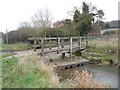
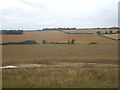
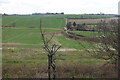
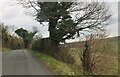
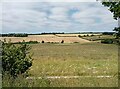
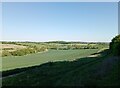
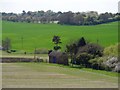
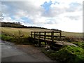
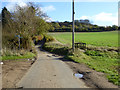
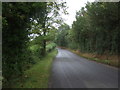
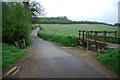
Living in Aston, Datchworth & Walkern Ward offers a distinctly rural experience within East Hertfordshire. This electoral ward, identified by ONS code E05015354, encompasses three specific villages that define the daily rhythm of the area. Covering a total land area of 36.8 km², the ward balances village life with proximity to the wider region. The location coordinates 51.8917° N, 0.1286° W place the ward primarily within postcodes SG2 and SG3. You will find yourself situated in a region where conservation matters, as there is an established Aston Conservation Area. Planning proposals noted as far back as 2004 indicate a commitment to extending these designated boundaries to protect the local character. Homebuyers seeking a settled environment away from urban congestion look frequently to these wards. The setting supports a quiet pace of life while maintaining essential links to Hertfordshire's infrastructure. Residents enjoy the privacy of rural living without being entirely isolated from administrative centres. The ward structure integrates these distinct communities into a single planning unit, streamlining local governance while preserving village identities.
- Area Type
- District Borough Unitary Ward
- Area Size
- 36.8 km²
- Population
- Not available
- Population Density
- Not available
Demographics
The community profile of Aston, Datchworth & Walkern Ward reflects an established, settled population with clear generational roots. Survey data indicates a median age of 70, suggesting the area is home to a significant proportion of older residents. This age distribution aligns with the region's reputation for retirement and long-term residency. Current figures show that 71 percent of households own their homes, a figure that points to a stable community with high levels of residence security. This ownership rate significantly exceeds typical national averages for similar rural districts, indicating deep community ties. The remaining 29 percent of the population likely rents or lives in other tenure arrangements. You can expect a neighbourhood where residents have lived for decades, creating intergenerational friendships and neighbourhood watch networks. The ward data categorises household composition and accommodation types under general totals, underscoring the uniformity of living standards across the three villages. There is no indication of a transient population flow. Instead, the demographics paint a picture of permanence. Prospective buyers should expect neighbours who are invested in the well-being of Aston, Datchworth & Walkern Ward and its surrounding green spaces.
Household Size
Accommodation Type
Tenure
Ethnic Group
Religion
Household Composition
Age
Household Deprivation
NS-SEC
Explore more demographic insights in this area
Go to Demographics tabPlanning
Planning Constraints
- Flood RiskPremium
- Ramsar Wetland SitesPremium
- Area of Outstanding Natural BeautyPremium
- Protected Nature ReservePremium
- Protected WoodlandPremium
- Crime RiskPremium