Area Overview for Aspley & Woburn Ward
Photos of Aspley & Woburn Ward


Area Information
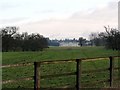
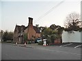
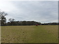
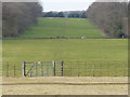
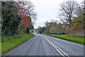
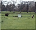
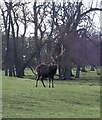
Living in Aspley & Woburn Ward offers a specific lifestyle defined by its physical scale and demographic profile. This district borough unitary ward covers an area of 54 square kilometres, providing a broad canvas for residential development. You are moving into a community where the median age sits at 70 years, indicating a population dominated by older residents. This is not a typical family-centric neighbourhood but rather a settlement designed for those retired or settled in later life. Daily life here revolves around the quiet rhythm of age-restricted living rather than the chaos of a school-run district. The absence of young families shapes the noise levels and the general pace of the locality. Prospective buyers should understand that the social energy of the area is dictated by this elderly profile. The large land mass ensures there is space, but the people are distinct. You are entering a market where home ownership is the norm, reflecting long-term residency. The environment is free from major planning constraints like Ramsar sites or Areas of Outstanding Natural Beauty, meaning development is possible but monitored against protected woodlands. This area is distinct because it ages well; there are no restrictions limiting household growth, yet the current population has chosen to settle here for the life it offers.
- Area Type
- District Borough Unitary Ward
- Area Size
- 54.0 km²
- Population
- Not available
- Population Density
- Not available
Demographics
The community within Aspley & Woburn Ward is characterised almost entirely by an older demographic. With a median age of 70, the centre of gravity for any household activity rests firmly with retirees. Age Statistics Total suggests that the majority of occupants in the ward falls into the broader age categories typical for this profile. You should expect a neighbourhood where neighbours know each other because medical circumstances and social routines converge. The home ownership rate stands at 66 per cent, which confirms that most residents bought their properties years ago and have no intention of moving. This high level of tenure means rental stock is scarce, and those looking to buy homes in Aspley & Woburn Ward will find a stable, non-transient population. Household composition data does not specify single-person or family breakdowns, but the median age implies that single-occupancy or joint-retirement homes dominate the map. Accommodation type statistics are aggregated, but the ownership figure drives the density of proprietor-occupied dwellings. The ethnic and religious data are not itemised in the source, so you cannot assume a diverse or specific cultural landscape. Your quality of life here is defined by stability rather than the vibrancy of a mixed-age community. The age profile means local shops serve older shoppers, and leisure activities cater to mobility levels appropriate for someone over 70. There are no young parents to complain about weekends or mornings.
Household Size
Accommodation Type
Tenure
Ethnic Group
Religion
Household Composition
Age
Household Deprivation
NS-SEC
Explore more demographic insights in this area
Go to Demographics tabPlanning
Planning Constraints
- Flood RiskPremium
- Ramsar Wetland SitesPremium
- Area of Outstanding Natural BeautyPremium
- Protected Nature ReservePremium
- Protected WoodlandPremium
- Crime RiskPremium