Area Overview for Aspall
Photos of Aspall
Area Information
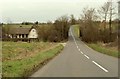
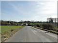
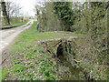
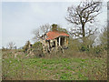
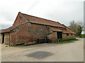
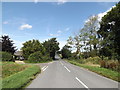
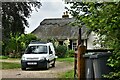
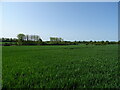
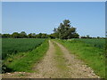
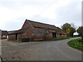
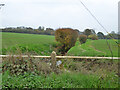
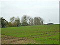
Living in Aspall means settling into a compact civil parish spanning 3.4 square kilometres. This small locality offers a contained environment where residents navigate defined boundaries and established routes. The setting provides a quiet backdrop for daily life, distinct from the larger towns nearby. You can expect a pace of life that values stillness and space within a clearly defined geographical area. When considering homes in Aspall, you are looking at a specific pocket of England where the local character remains consistent across the entire parish. The size of the area ensures that the community feels intimate, yet it lacks the anonymity of a major urban centre. Every street and path within these three square kilometres contributes to the daily rhythm of the place. Prospective buyers find an environment where the distinction between residential and open land is often sharp. Renowned for its cultural heritage, this parish features the famous Felbrigg Hall estate, though the specific boundaries of the residential pocket are defined by the parish limits. The distinct identity of Aspall comes from its historic status and the surrounding landscape. You move through a setting where the past influences the current housing stock and local planning. The area avoids the extremes of high-density development found elsewhere. Instead, the 3.4 km² footprint sustains a lifestyle heavily reliant on local amenities and personal transport. The compact nature means you visit the same spots daily, creating a deep familiarity with your surroundings. This is a place where the environment shapes the experience of living, rather than impersonal housing estates.
- Area Type
- Parish
- Area Size
- 3.4 km²
- Population
- Not available
- Population Density
- Not available
Demographics
The community profile of Aspall reflects a settled population with a significant portion of residents aged 70 or older. This median age indicates a demographic dominated by older households. Living in Aspall involves engaging with a society where longevity is the norm, and generational roots often run deep within the local families. The household composition leans heavily toward established families and individuals who have remained through the decades. The predominantly older age group is mirrored in the high level of home ownership, which stands at 73 per cent. This statistic confirms that the vast majority of residents own their properties outright rather than renting. Nearly three quarters of households in this parish are owner-occupied, suggesting stability and long-term ties to the land. Accommodation types align with this ownership trend, featuring substantial properties suited to older residents. The low rental proportion means that the housing market operates more as a owners' domain. You will rarely encounter short-term lets or temporary housing in this setting. The demographic reality shapes the local schools near Aspall, which likely cater to younger populations drawn in by the area's heritage or specific amenities. Despite the aging population, the presence of school-aged children suggests occasional influxes of families seeking specific locations. The absence of significant stock changes keeps the community consistent, with the 73 per cent ownership figure remaining a defining statistic for anyone assessing the neighbourhood composition.
Household Size
Accommodation Type
Tenure
Ethnic Group
Religion
Household Composition
Age
Household Deprivation
NS-SEC
Explore more demographic insights in this area
Go to Demographics tabPlanning
Planning Constraints
- Flood RiskPremium
- Ramsar Wetland SitesPremium
- Area of Outstanding Natural BeautyPremium
- Protected Nature ReservePremium
- Protected WoodlandPremium
- Crime RiskPremium