Area Overview for Ashwicken
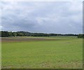
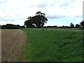
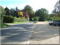
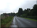
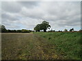
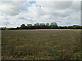
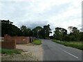
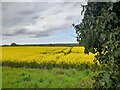
Photos of Ashwicken
Area Information
Living in Ashwicken offers a compact, established environment within England’s built-up areas. Covering 25 hectares, the area is small but functional, with a median age of 70, suggesting a community of older residents. This is not a rapidly expanding town but one with a settled character. Daily life is shaped by proximity to essential services, including a primary school with a good Ofsted rating and nearby retail options. The area’s safety score of 79/100 indicates a low crime risk, which is reassuring for residents. While Ashwicken lacks the density of larger cities, its practical layout and access to transport networks, such as rail and ferry services, provide connectivity to surrounding regions. For those seeking a quiet, low-maintenance lifestyle with proximity to amenities, Ashwicken’s blend of modest scale and accessibility may appeal. However, its demographic profile and limited data on diversity suggest a specific, perhaps older, population base.
- Area Type
- Built Up Area 250
- Area Size
- 25.0 hectares
- Population
- Not available
- Population Density
- Not available
Ashwicken’s lifestyle is shaped by its proximity to essential amenities, including five retail outlets such as Morrisons Daily Kings, Asda South, and Sainsburys Kings. These shops provide convenience for daily shopping, from groceries to household items. The area’s rail connection to Kings Lynn Railway Station and ferry access to King’s Lynn and West Lynn offer flexibility for travel, whether for work, leisure, or visiting nearby towns. While the data does not mention parks or leisure facilities, the presence of multiple retail options and transport links suggests a focus on practicality over expansive recreational spaces. For residents, this means a lifestyle centred on accessibility and routine, with limited opportunities for outdoor activities unless they venture beyond the immediate area.
Amenities
Schools
The nearest school to Ashwicken is the Ashwicken Church of England Voluntary Aided Primary School, which serves the local community with a good Ofsted rating. This primary school is the only educational institution explicitly listed in the data, meaning families with older children may need to look beyond the immediate area for secondary education. The presence of a primary school with a good rating is a positive for families prioritising early education, but the lack of secondary schools nearby could be a consideration for those requiring a full range of schooling options. The school’s status as a voluntary aided institution suggests it may have specific religious affiliations or governance structures, which could influence its curriculum or policies.
| Rank | A + A* % | School | Type | Entry gender | Ages |
|---|---|---|---|---|---|
| 1 | N/A | Ashwicken Church of England Voluntary Aided Primary School | primary | N/A | N/A |
Explore more schools in this area
Go to Schools tabDemographics
Ashwicken’s population is predominantly older, with a median age of 70, reflecting a community where retirees or long-term residents form the majority. Home ownership is high at 70%, indicating a stable housing market with fewer rental properties. The data does not specify household composition or ethnic diversity, but the prevalence of owner-occupied homes suggests a mature demographic with long-term ties to the area. The accommodation types are not detailed, but the high home ownership rate implies a mix of family homes and single-occupancy properties. While no figures on deprivation or diversity are provided, the lack of rental properties may limit opportunities for younger buyers or those seeking transient housing. The area’s character is defined by its older population and established housing stock, which may appeal to those prioritising stability over dynamic growth.
Household Size
Accommodation Type
Tenure
Ethnic Group
Religion
Household Composition
Age
Household Deprivation
NS-SEC
Explore more demographic insights in this area
Go to Demographics tabPlanning
Planning Constraints
- Crime RiskLocked