Area Overview for Ashwell
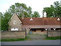
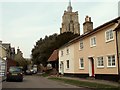
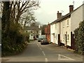
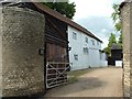
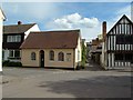
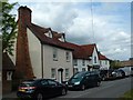
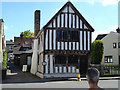
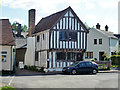
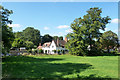
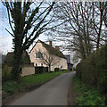
Photos of Ashwell


Area Information
Ashwell is a compact built-up area spanning 72.9 hectares, offering a blend of residential living and practical connectivity. With a median age of 70, the community reflects a mature demographic, suggesting a settled, long-term population. The area’s proximity to multiple railway stations, including Ashwell & Morden and Baldock, ensures easy access to nearby towns and cities. Residents benefit from a broadband score of 92, indicating excellent digital connectivity, which supports remote work and everyday internet use. The low crime risk, with a safety score of 78, reinforces Ashwell’s appeal as a secure place to live. Nearby amenities such as Ashwell Primary School and retail hubs like M&S Baldock and Tesco Baldock contribute to a convenient lifestyle. While the area’s size is modest, its strategic location and infrastructure make it a practical choice for those seeking a quiet yet connected home.
- Area Type
- Built Up Area 250
- Area Size
- 72.9 hectares
- Population
- Not available
- Population Density
- Not available
Ashwell’s lifestyle is defined by its proximity to essential amenities and practical connectivity. Local retail options include M&S Baldock, Co-op Stotfold, and Tesco Baldock, offering everyday shopping and services. The railway stations—Ashwell & Morden, Baldock, and Arlesey—provide easy access to nearby towns, enhancing commuting and leisure opportunities. While the area’s size is modest, the availability of retail and transport hubs ensures convenience. The presence of Ashwell Primary School adds to the community’s appeal for families. The overall character is suburban, with a focus on accessibility and simplicity, making it suitable for those prioritising practicality over expansive urban amenities.
Amenities
Schools
Ashwell Primary School is the only named school in the data, offering primary education with a good Ofsted rating. This indicates a reliable foundation for younger children’s education, though no secondary schools are listed. The single primary school suggests families may need to look beyond the immediate area for secondary options, but the good rating ensures quality at the primary level. The absence of further educational institutions means the school mix is limited, but the existing school meets standard benchmarks. For parents prioritising primary education, Ashwell’s school provides a solid starting point, though broader educational needs may require additional planning.
| Rank | A + A* % | School | Type | Entry gender | Ages |
|---|---|---|---|---|---|
| 1 | N/A | Ashwell Primary School | primary | N/A | N/A |
Explore more schools in this area
Go to Schools tabDemographics
Ashwell’s population is predominantly older, with a median age of 70, reflecting a community shaped by long-term residents. Home ownership stands at 74%, indicating a strong presence of owner-occupied properties. The data does not specify household types or accommodation styles, but the high home ownership rate suggests stability and a focus on residential permanence. The area’s demographics do not highlight significant diversity in ethnicity or religion, though this does not necessarily reflect the full picture. For residents, the older age profile may influence local services and social dynamics, with a focus on established community networks. The lack of detailed breakdowns on household composition or diversity means broader trends remain unexplored, but the data confirms a settled, low-turnover population.
Household Size
Accommodation Type
Tenure
Ethnic Group
Religion
Household Composition
Age
Household Deprivation
NS-SEC
Explore more demographic insights in this area
Go to Demographics tabPlanning
Planning Constraints
- Crime RiskLocked