Area Overview for Ashdon
Photos of Ashdon


Area Information
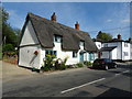
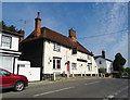
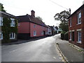
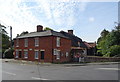
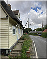
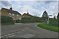
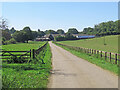
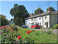
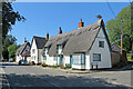
Ashdon is a compact built-up area in England, covering 24.3 hectares. Its population, while not explicitly stated, is reflected in its median age of 70, suggesting a community skewed towards older residents. The area is characterised by a high rate of home ownership—79% of households own their homes—indicating a stable, long-term resident base. Daily life in Ashdon is shaped by its proximity to essential services and transport links. Residents benefit from nearby retail outlets such as Co-op Linton, Tesco Saffron, and Waitrose Saffron, offering convenience for shopping. The area’s rail connectivity is strong, with Great Chesterford and Audley End railway stations providing access to broader regional networks. For families, Ashdon Primary School, rated 'good' by Ofsted, is a key local asset. While the area’s size is modest, its amenities and infrastructure cater to a range of needs, from commuting to leisure. Living in Ashdon suits those seeking a quieter, established neighbourhood with a mix of practicality and accessibility.
- Area Type
- Built Up Area 250
- Area Size
- 24.3 hectares
- Population
- Not available
- Population Density
- Not available
Ashdon’s lifestyle is shaped by its proximity to practical amenities. The area includes five retail outlets, such as Co-op Linton, Tesco Saffron, and Waitrose Saffron, offering a range of shopping options. These stores cater to daily needs, from groceries to household supplies. The two railway stations—Great Chesterford and Audley End—provide easy access to broader transport networks, supporting both commuting and leisure travel. While the data does not mention parks or leisure facilities, the presence of retail and rail infrastructure suggests a focus on convenience over expansive recreational spaces. Residents benefit from a compact, service-oriented environment, ideal for those prioritising accessibility over large-scale amenities.
Amenities
Schools
Ashdon Primary School is the only school explicitly listed in the area. It is a primary school with a 'good' Ofsted rating, indicating a satisfactory standard of education. While no secondary schools are mentioned, the presence of a primary school with a positive rating is a key consideration for families. The absence of additional educational institutions suggests that residents may need to travel to nearby towns for secondary schooling. For those prioritising primary education, Ashdon Primary School offers a reliable option, though the broader school landscape remains unclear. Parents should factor in the need for commuting to secondary schools when evaluating the area’s suitability for their children’s education.
| Rank | School | Type | Entry gender | Ages |
|---|
Explore more schools in this area
Go to Schools tabDemographics
Ashdon’s population has a median age of 70, placing it well above the national average. This suggests a community predominantly composed of older adults, with the most common age range encompassing all demographics. Home ownership is high, at 79%, reflecting a strong presence of long-term residents. The data does not specify household types or accommodation categories, but the overall home ownership rate indicates a stable housing market. The predominant ethnic group and religious composition are not detailed, so broader demographic insights are limited. The area’s age profile may influence local services and amenities, with a focus on healthcare and community support. While the data does not quantify deprivation levels, the high home ownership and low crime risk suggest a relatively secure and self-sufficient population. For prospective buyers, this demographic profile may align with those seeking a mature, low-maintenance environment.
Household Size
Accommodation Type
Tenure
Ethnic Group
Religion
Household Composition
Age
Household Deprivation
NS-SEC
Explore more demographic insights in this area
Go to Demographics tabPlanning
Planning Constraints
- Crime RiskPremium